UGRWCD Awards 2025 Grant Funding

What’s Next for Colorado River Negotiations? By The Colorado Sun


Colorado Open Lands Seeks Dryland Restoration Coordinator
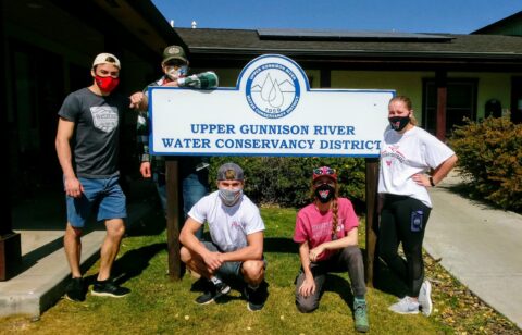
THANKS TO BUCKEL FAMILY WINE FOR HOSTING “WELCOME WATER & WINE”

![]()
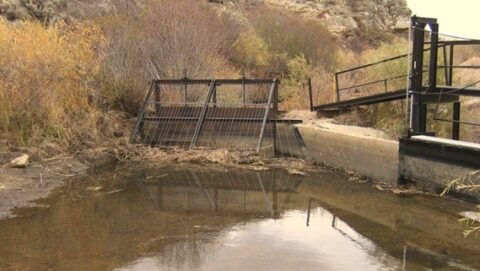
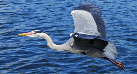
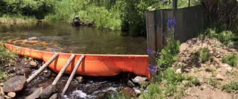
TAYLOR LOCAL USER’S GROUP RECOMMEND RELEASES FROM TAYLOR PARK RESERVOIR
TAYLOR LOCAL USERS GROUP (TLUG) RECOMMEND RELEASES THROUGH SEPTEMBER 4, 2025 (PENDING HYDROLOGY OR MID-MONTH FORECAST https://ugrwcd.org/tlug/
![]()
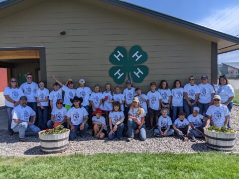
UGRWCD HOSTS STUDENTS FROM LEAD HOMESCHOOL ENRICHMENT PROGRAM
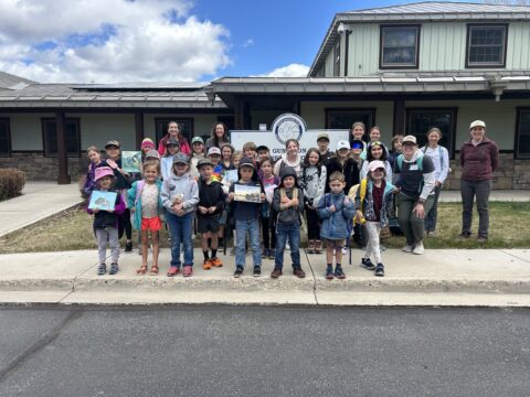
UGRWCD HOSTS STUDENTS FROM THE LEAD HOMESCHOOL ENRICHMENT PROGRAM FOR A MORNING OF WATERSHED EDUCATION
Nearly 40 students and program leaders visited the District’s facility on May 15, 2025 for a morning of learning about the Upper Gunnison River watershed. District staff provided instruction on aquatic nuisance species and water quality testing, the advantages of and building Wet Meadows Restoration structures, and lessons on streamflow and riparian concepts at the Water Wonder Trailer. Following the morning of hands-on learning, the students enjoyed a picnic lunch. This visit to the UGRWCD was made possible by a UGRWCD Mini-Grant.
![]()
![]()
![]()
![]()
![]()
![]()
UGRWCD Sponsors “Blessing of the Ditches Picnic and Celebration”
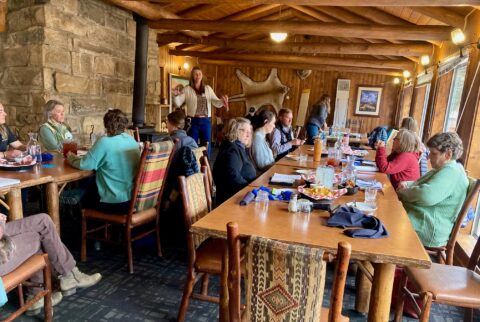
UGRWCD Supports the “Blessing of the Ditches”
Picnic and Celebration
Over 100 individuals and families enjoyed sunshine, a picnic, original music, speakers, vendors and plenty of “ditch” fun at the “Blessing of the Ditches” on Saturday, May 18th, 2025 at Meadow Park. This Celebration was made possible in part by a UGRWCD Mini-Grant. Special thanks to the organizers, volunteers, musicians and speakers who made this event such a success!
![]()
![]()
![]()
UGRWCD MINI-GRANT SUPPORTS GUNNISON VALLEY ENVIRONMENTAL EDUCATION COUNCIL
UGRWCD Supports new Gunnison Valley Environmental Education Council
Are you an educator and interested in collaborating with other teachers, professors and environmental specialists on ideas and curriculum to help prepare students for taking care of our planet in the future? Please see the SWOT Analysis HERE that was developed during the first meeting of the council. If you are interested in joining the Council for future meetings, please email organizers Katya Schloesser at Katya.Schloesser@Colorado.Edu or Katie Lawn at katielawn@rmbl.org.
![]()
![]()
.
COLORADO RIVER DISTRICT HOSTS “STATE OF THE RIVER” IN GUNNISON ON APRIL 17TH
COLORADO RIVER WATER CONSERVATION DISTRICT TO HOST “STATE OF THE RIVER” EVENT ON APRIL 17TH AT FRED FIELD CENTER AT GUNNISON FAIRGROUNDS!
The Colorado River District’s State of the River meetings are back for 2025! These free public events bring together water experts, community members, and local leaders to discuss the future of our rivers.
From flow forecasts to local water projects and the challenges shaping Western Colorado’s water supply, these meetings give you a front-row seat to your area’s most important water discussions.
Register HERE!
IMPROVING BASIN WATER RESOURCES ONE PROJECT AT A TIME
Please Enjoy Regular Water Articles Published in the “Gunnison Country Times”
The Upper Gunnison River Water Conservancy District is pleased to partner with the Gunnison Country Times to provide on-going regular water articles. As we work throughout the basin, the one message our staff repeatedly hears is that our neighbors are hungry for more water information and education. Our hope is that with these articles we can highlight the many ways in which it touches our lives and keep you up to speed on the rapidly changing landscape that is water. We encourage you to write to us at info@ugrwcd.org and let us know if there are topics you’d like us to cover. Thank you for reading and being good stewards of our basin! — Sonja Chavez, General Manager
In addition to the publication in the newspaper, we would like to share them with you on our website, too, so to read the article, please click HERE
![]()
EMPLOYMENT OPPORTUNITY! UGRWCD to Hire 2 Summer Wet Meadows Technicians
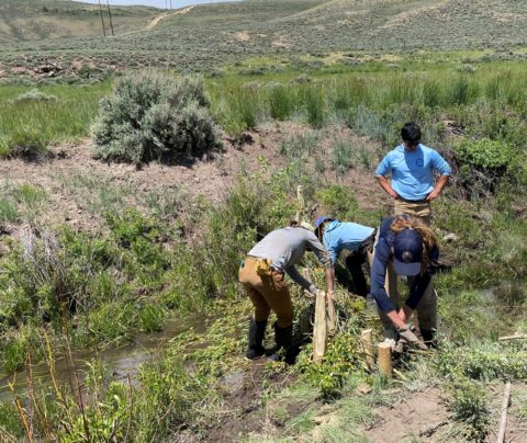
SEASONAL POSITION OPENINGS! The Upper Gunnison River Water Conservancy District is seeking two temporary, seasonal restoration technicians to help implement projects for the Wet Meadows Restoration Program. These positions will be responsible for implementing various restoration projects and treatments in the Upper Gunnison Basin sagebrush ecosystem. Crew members must be comfortable working in remote field settings, operating 4WD vehicles over rugged terrain, doing physically intense labor, and working in settings where there are ticks, mosquitoes, and extreme weather. Bachelor’s degree or current enrollment in hydrology, natural resource management, watershed management, or related field is required. Hourly pay is $21.00/hr. Please submit a cover letter, resume, and two references to: aaulenbach@ugrwcd.org. Read the complete job description HERE:
![]()
SEASONAL POSITION OPENINGS! Wet Meadows technicians are hard at work building structures for water retention and restoration.
UGRWCD Co-sponsors CB Public Policy Forum on August 1st – Planetary Health
![]() Sam Myers , “ Planetary Health”
Sam Myers , “ Planetary Health”
Tuesday, August 1, 2023
7:00 PM – 8:30 PM
Crested Butte Center for the Arts
Sam Myers is a Principal Research Scientist at the Harvard School of Public Health and is the founding Director of the Planetary Health Alliance (www.planetaryhealthalliance.org).
Sam’s research explores Planetary Health—a field focused on the human health impacts of global environmental change. His projects currently include exploring the human nutritional consequences of rising concentrations of CO2 in the atmosphere, falling populations of pollinating insects, and changes in global fisheries in response to ocean warming. He is interested in policy interventions to improve human health while stabilizing Earth’s natural systems. As the Director of the Planetary Health Alliance, Sam oversees a multi-institutional effort (over 350 organizations in over 65 countries) focused on understanding and quantifying the human health impacts of global environmental change and translating that understanding into action globally. For his research, Dr. Myers was the inaugural recipient of the Arrell Global Food Innovation Award in 2018 and Prince Albert II of Monaco prize for research at the interface of health and environment in 2015. He is the co-editor with Howard Frumkin of Planetary Health: Protecting Nature to Protect Ourselves published in August 2020, and he has authored over 100 peer reviewed articles and book chapters.
Generously Co-Sponsored by the Upper Gunnison Water River Conservancy District
The Crested Butte Public Policy Forum is an avenue for information, not advocacy. The speakers reflect a wide range of ideologies, beliefs, and political affiliations.
The Forum is not associated with a particular political party nor does it espouse a particular political ideology.
UGRWCD Announces Phase 1 Completion of Geo-Fluvial Assessment
![]()
The UGRWCD recently published Phase I of the “Geo-Fluvial Assessment” as part of the Watershed Management Program committee goals. To read the full report, please click here:
![]()
UGRWCD Purchases Suite A at 210 West Spencer, Gunnison
UGRWCD ANNOUNCES PURCHASE OF “UNIT A” AT THE SPENCER AVENUE BUSINESS PARK CONDOMINIUMS (FORMERLY THE BUREAU OF LAND MANAGEMENT OFFICE)
FOR IMMEDIATE RELEASE
On May 12, 2023, the Upper Gunnison River Water Conservancy District purchased Unit A of the Spencer Avenue Business Park Condominiums for the purchase price of $650,000. The space was previously occupied by the Bureau of Land Management. The District has owned Units B and C since 2009 and now owns all units in the building.
Since 2019, the District has hired one full-time employee, one part-time employee, and two temporary or seasonal employees in order to provide more and better service to the community consistent with its mission. This increase in staff has not resulted in an increase in the District’s overall budget, or its mill levy, but has created the need for more efficient office space. In order to create additional office space, a small temporary work room is being utilized by one staff member and a copy room was renovated to create a second office space. The existing area is confined, creating issues around noise and inability to work effectively with the public .
As part of the decision-making process, the Board of Directors evaluated the need for space, ability to do further renovations within the confines of the District’s existing space, potential for future growth of the organization, cost of a renovation versus purchasing the space next door, uncertainty around compatibility of potential neighbors, and fiscal impact.
A thorough evaluation of the fiscal impact to the District was conducted and the purchase was found to be a sound financial decision and a responsible use of District funds. The purchase was made with a portion of the District’s reserves, which was invested in low-yielding bonds as a result of the current financial markets. The District retains substantial liquid reserves. Once the District staff move into the new quarters, the District will lease its existing space to a compatible entity, and segregate individual offices in Unit A, providing a return on investment many times greater than the bonds. That return will also provide cost recovery for the purchase.
The District’s move into Unit A will likely occur in the fall of 2023.
UGRWCD Awards 2023 Grant Funding
2023 GRANT FUNDS SUPPORT NUMEROUS PROJECTS THROUGHOUT UPPER GUNNISON BASIN
The Board of Directors of the Upper Gunnison River Water Conservancy District (UGRWCD) voted at the March 27th Board meeting to award $297,170 to organizations and individuals in the Upper Gunnison River Basin. These grant funds will be used for projects that will enhance water supply, improve stream and irrigation conditions, conserve water, provide water education benefits and restore wetlands. There was a diverse group of project applications from all over the Upper Gunnison River. Examples include a City of Gunnison native plant xeriscape project at 11th & Quartz Street intersection with educational signage, Coal Creek Dam Construction (Lake Irwin), and irrigation demonstration projects – one utilizing a combined plastic irrigation pipe, headwall, and turnout gate for improved irrigation water management and another utilizing an IntelliDitch HDPE Liner to prevent seepage loss.
All applicants were required to provide a 50 percent cost match and their projects had to be consistent with the District’s purpose, mission, and objectives.
UGRWCD General Manager Sonja Chavez noted during this year’s funding cycle, the District received requests for funding that totaled $370,613.
“It was a very competitive cycle and I strongly encourage those who were not funded to reach out to us to discuss their project and how they can make it stronger for the next cycle,” said Sonja.
Sonja also pointed out the District Grant Funding Program is a prime example of the District’s responsible allocation of tax revenues to directly benefit diverse water improvement projects in the basin. “I am delighted to report that during this cycle, our District grant funds were leveraged at a ratio of 1:3 with outside funding sources which just amplifies returns on District investment.
The UGRWCD Grant Program follows an annual cycle with applications due in February each year. General Manager Chavez urges potential applicants or individuals, even those just wondering about a water project, to reach out to the District now so that the District can help with infrastructure assessment or engineering that can assist in ensuring that the project can be funded. If you have a water project in mind, please call the District at (970) 641-6065 to schedule a consultation.
UGRWCD Announces Contest for 2023 World Water Day!
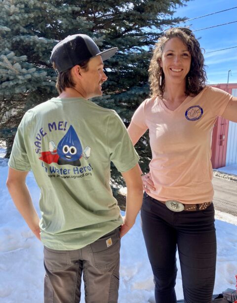
![]()
Water is LIFE! Win a T-Shirt!
In honor of World Water Day on Wednesday, March 22, 2023, the UGRWCD is hosting a trivia contest to promote water conservation and water education. Every day from now until 11:59 p.m. on Wednesday, March 22, 2023, participants can email the District at info@ugrwcd.org to submit their response to this trivia question: What percentage of the Colorado River originates from melting snowpack in the Rocky Mountain headwaters?
Each person who answers correctly wins a free “Save Me – Be A Water Hero” t-shirt in a color and size of their choosing. There are a variety of great colors and sizes to choose from in Women’s v-necks, Unisex crew necks and Youth short sleeve tees. (Limit one t-shirt per person.)
Winners will be notified by email and can pick up their t-shirt during UGRWCD’s regular business hours Monday through Friday 8 a.m. to 5 p.m. at 210 W. Spencer Avenue, Suite B. Help us spread the word about the importance of water in our rivers and reservoirs, Be A Water Hero, and win a t-shirt! Contest ends March 22nd.![]()
![]()
Winter 2022-2023 Newsletter
2023 District Grant Program Update
2023 District Grant Program Update The District is busy reviewing grant applications for its 2023 Grant Program and anticipates announcing the individuals and organizations who
Update on Drought and Snow Conditions
Update on 2023 Drought and Snow Conditions For the first time since early in 2019, a large portion of the Upper Gunnison River Basin is
Gunnison River Festival Announces Preliminary Schedule
GUNNISON RIVER FESTIVAL ANNOUNCES PRELIMINARY SCHEDULE FOR 2023 In 2023, the Gunnison River Festival will be underwriting river recreational events happening all across the Gunnison
Rosemary Carroll UGRWCD Board Member Profile
Rosemary Carroll – Board Profile Rosemary Carroll was appointed to the UGRWCD Board of Directors in August 2016 representing Division 5, Crested Butte. Her current
2023 District Grant Program Update
2023 District Grant Program Update
The District is busy reviewing grant applications for its 2023 Grant Program and anticipates announcing the individuals and organizations who will receive grant funding after the March 27, 2023 UGRWCD Board of Directors meeting at 5:30 p.m.
This cycle, a total of 19 grant applications were submitted requesting $371,113 in funding. The UGRWCD 2023 budget includes a Grant Program funding line item of $300,000. The total project costs for the 19 applications received is $4,956,429 (including the matching funds required by the District Grant program.) If all applications were to be funded in full, this would leverage every UGRWCD Grant Program dollar with outside funding or in-kind services at a ratio of 1:12.
For the first time this year, the grant application process included the requirement that individuals and organizations considering a funding request, contact the District to visit with staff about their proposed projects including any requests for pre-feasibility engineering. This opportunity was important not only for staff but also for the applicant. The applicant is able to explain their project and ask questions and the District staff leave with a very clear understanding of the applicants water resource issues and project goals.
“We are very pleased to have received such a great number of applications for very worthy projects,” said Beverly Richards, water resource specialist for the District. “As this program continues to grow, we can’t emphasize enough how important it is for those considering submitting a grant application to contact the District to discuss their project and determine if pre-feasibility engineering might be of help. Even though we are still completing this year’s grant funding cycle, it’s never too early to start planning your project. The District has an engineer on call to help with pre-feasibility planning and cost estimation.”
For more information, contact the District at 970-641-6065 or visit the website link: https://ugrwcd.org/grant-funding/
Update on Drought and Snow Conditions
![]()
Update on 2023 Drought and Snow Conditions
For the first time since early in 2019, a large portion of the Upper Gunnison River Basin is experiencing no drought conditions whatsoever, particularly in Gunnison and Saguache counties, which are currently 74 and 85 percent of the basin area respectively. This is a huge improvement from this same period in 2022 where these same areas were still experiencing the full range of drought conditions from abnormally dry to exceptional drought. The turnaround in these conditions was due in part to the monsoon rains the basin received in June, July and August 2022, which benefitted a good portion of western Colorado, as well as continued precipitation for December 2022 and January 2023. Even with this recent precipitation, water supply conditions within the basin remain low with streamflows throughout the water year below the historical average. Reservoir storage in the Upper Gunnison Basin currently stands at 41percent of full and the current snowpack is at 120 percent of normal. In 2022 conditions in the spring led to continued stress on the water supply due to low or no precipitation, severe wind events, and considerable dust on snow events. For 2023, the seasonal predictions for February, March and April state that there a 33 to 40 percent chance that precipitation will be below normal for the time period although the long-range weather forecast for March and April show several opportunities for more snow. Thankfully, due to precipitation received over the past several months in the Upper Gunnison Basin, soil moisture should not be a factor in reduced snow runoff.
Gunnison River Festival Announces Preliminary Schedule
GUNNISON RIVER FESTIVAL ANNOUNCES PRELIMINARY SCHEDULE FOR 2023
In 2023, the Gunnison River Festival will be underwriting river recreational events happening all across the Gunnison Valley through community partners.
This schedule is just a start! Check back at https://ugrwcd.org/gunnison-river-festival/ on how you can “Celebrate our Rivers” as the schedule is updated with newly sponsored events:
- April 22nd – Kick off with River Clean Up hosted by the City of Gunnison and the Upper Gunnison River Water Conservancy District
- April 27th –Fly Fishing Film Festival hosted by the Gunnison Angling Society
- May 19th – 4th Grade Water Festival hosted by the Gunnison Conservation District
- June 9th – Taylor River Race hosted by the Upper Gunnison River Water Conservancy District
- June 10th – What’SUP on the Slate hosted by the Upper Gunnison River Water Conservancy District
- July 1st – Sunni Gunni Costume Float & River Celebration hosted by the Upper Gunnison River Water Conservancy District
- July 14th & 15th – Caddis Cup hosted by the Crested Butte Land Trust
A full schedule of programming will be released this Spring. Expect to see lots of rafting, kayaking, SUPing, river surfing and educational clinics throughout our watershed in 2023.
Another focus of the Gunnison River Festival this year is to “Be A River Hero” which means being smart about the river, and choosing to practice river safety, responsible river stewardship and respectful etiquette. Being a River Hero means that everyone gets to enjoy the river both today and tomorrow.
If you have questions about an event or project this spring or summer that might fall under the Gunnison River Festival umbrella or if you would like to volunteer, please contact the Gunnison River Festival Executive Director Cheryl Cwelich at 970-641-6065.
![]()
Rosemary Carroll UGRWCD Board Member Profile
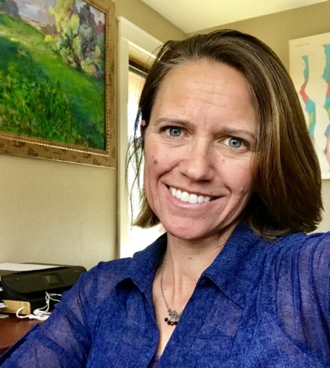
![]()
Rosemary Carroll – Board Profile
Rosemary Carroll was appointed to the UGRWCD Board of Directors in August 2016 representing Division 5, Crested Butte. Her current term expires in June 2023. Rosemary is a Research Professor in the Desert Research Institute’s (DRI) Division of Hydrologic Sciences. She has been a member of the DRI community since 2000 when she was hired as a research hydrologist. Rosemary earned her Master’s and Ph.D. in hydrology at the University of Nevada, Reno. After completing her Master’s degree and joining DRI, Rosemary has primarily worked on surface water and groundwater modeling projects. Dr. Carroll lives in Mt. Crested Butte and conducts research within the Upper Gunnison watershed from Paradise Divide all the way down to Almont.
Rosemary grew up in Vermont, and during and after college lived as a self-proclaimed “river rat and ski bum” in California. She met her future husband and Gunnison native, Torrey Carroll, while working as a raft guide in the Sierra Nevada Mountain Range and moved to Crested Butte in 1990-96. Shortly after moving to the Gunnison Valley, Carroll went back to school at Western Colorado University to build on her undergraduate Physics degree to become a science teacher and found herself taking as many geology classes as she could. When her professor asked Rosemary what she really loved to do, she answered “study water systems” which eventually led her to study hydrology at the University of Nevada-Reno. She moved back to Crested Butte in 2006 to raise her children and be closer to family. She found she was in the right place at the right time as the East River near Crested Butte became the hydrology mecca for scientists from around the country. Specifically, Rosemary’s research is part of the Department of Energy funded program through the Lawrence Berkeley National Laboratory (LBNL) that includes collaboration with over 150 scientists and coordination with multiple federal, state and local stakeholder groups.
Rosemary says that the Upper Gunnison watershed serves as a representative watershed for the Upper Colorado River Basin . “The research data and hydrologic modeling that we do in the East River is important to understanding local hydrological dynamics, but it also is broadly representative of many mountain systems in the west and can help the water community understand how water travels down from mountain headwaters to the streams and reservoirs below,” said Rosemary. “Hopefully, water managers can utilize this data and modeling to better predict streamflow amount and quantity and make decisions to manage and conserve the water during dry periods.”
“The Colorado River receives nearly 90 percent of its water from the snow-fed mountains of Colorado, Wyoming and Utah,” said Carroll. “And, one-sixth of the world’s population receives its water from mountain watersheds, so it is crucial that we better understand mountain systems and work to conserve and protect them.”
“I really enjoy being on the Board (UGRWCD) and have learned so much from interactions with other Board members,” said Rosemary. “We are a very diverse group of individuals with different points of view, yet we are able to have kind, respectful discussions about our different opinions and can reach a consensus on decisions. Ultimately, we all want to see our river system benefit water users of all types and be protected and conserved for future use.”
Rosemary noted that during her tenure on the Board, she is most proud of the growth she has seen in the District’s grant programming. “It gives me great joy to be able to award $300,000 for a wide variety of water projects including everything from improving irrigation, to a native plant xeriscaping to a potable water loss study,” said Rosemary. “I love that the grant program can be a benefit to a small rancher, or a nonprofit group or even a municipality.”
Rosemary also feels that the Watershed Management Program, under the UGRWCD’s umbrella, is a “cutting edge” program where the District has been a leader in the state on collaborating with the science community for more effective watershed management. In addition, she feels stakeholder’s have provided the scientific community insight into watershed management concerns and offered guidance on what questions scientists should ask.
Rosemary said that although climate change and growing population and development along watershed can seem daunting, she does believe that together scientists and stakeholders can come up with solutions to manage concerns well into the future.
UGRWCD General Manager Sonja Chavez said Rosemary has been such a huge asset to the District Board, especially when it comes to making that connection between science and the development of water management tools. “The information Rosemary brings to each Board meeting about water resource research going on in our basin and throughout the west has been invaluable to the District,” said Sonja. “Not only has she been a huge help in explaining and simplifying data, but she has also provides a tremendous connection between the District and the scientific community. It is truly rare and we are so fortunate to have a Board member with such extensive knowledge and background in helping us meet the District’s mission.”
In her limited free time, Rosemary cherishes being outdoors on a long run through the wilderness, or hiking up a peak or skiing down a slope. She also enjoys spending time with her husband and also her two sons when they are home from college. Rosemary said, “I feel so blessed to live in this paradise and be able to work through my career and the District Board to preserve it!”
UGRWCD Seeks Consultant for Wetland Assessment Services
UGRWCD Seeks Consultant for Westland Assessment Services!
The Upper Gunnison River Water Conservancy District (District) is pleased to solicit responses from qualified consultants to a Request For Proposals (RFP) for wetland assessment services (issued on a Task Order basis). For complete details, please READ MORE HERE:
Seeking applicants to represent “Homeowner’s Interests” for Taylor Local Users Group
UGRWCD is seeking applicants to serve as Taylor Local Users Group representative for “Homeowner’s Interests”
If you own property along the Taylor River or Gunnison River in the Upper Gunnison Basin and would like to represent fellow property owners in making recommendations for Taylor Reservoir operations, including releases, please submit letters of interest to the District as soon as possible. The first Taylor Local Users Group meeting for 2023 will be held Friday, March 17, 2023 at 1 p.m. For complete details and instructions, please Read more here:
UGRWCD Announces 2023 Grant Program – Application Deadline is February 15, 2023
![]()
UGRWCD Announces $300,000 in Grant Funding Opportunities for 2023.
Applications for both new and completed projects are due by February 15, 2023. For complete packet details, please READ MORE HERE:
Gunnison River Festival Announces Preliminary 2023 Program
![]()
The Gunnison River Festival will host a “Celebration of our Rivers” all summer in 2023!
Please visit the Gunnison River Festival page often to catch up on all of the events throughout the spring and summer in 2023! Read more here:
Trout Unlimited Seeks Applications for Drought Resiliency Projects
![]()
Trout Unlimited Seeks Applications from Ag Producers located within the Tomichi and Escalante Watershed for Projects to Increase Drought Resiliency
Trout Unlimited has been awarded Natural Resources Conservation Service (NRCS) funding to support ag producer projects to help mitigate impacts of drought. Read more here:
The Baille Bank Restoration Project is an example of such an improvement project.
Summer 2022 Newsletter
Promoting Pollinators and Protecting Resources
Promoting Pollinators and Protecting Resources On June 8, 2022, Colorado Governor Jared Polis signed House Bill 22-1151 which allocates $2 million for a Turf Replacement
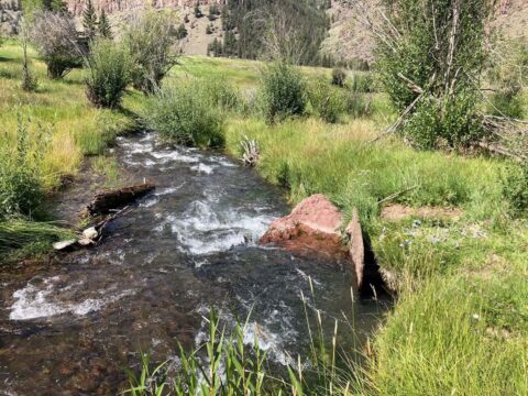
Conservation through Wet Meadows Projects
CONSERVATION THROUGH WET MEADOWS PROJECTS by Cheryl Cwelich, Watershed Programs Coordinator In the early morning light, the rolling sagebrush landscape is a soft green and
Sowing Seeds of Resiliency with Mark Tardiff
Sowing Seeds of Resiliency with Mark Tardiff As the monsoon clouds softly release some light raindrops, a hillside of colorful patches of Blue Flax, Showy
Julie Nania UGRWCD Board Member Profile
Julie Nania was appointed to the UGRWCD Board of Directors in June 2017 representing Division 5, Crested Butte. Her current term, her second, expires in
Promoting Pollinators and Protecting Resources
![]()
Promoting Pollinators and Protecting Resources
On June 8, 2022, Colorado Governor Jared Polis signed House Bill 22-1151 which allocates $2 million for a Turf Replacement Program in the state during fiscal year 2022-2023. In a nutshell, the program will pay individual and corporate property owners to replace irrigated turf with drought-resistant flowers, shrubs and grasses, known as “xeriscaping.” The purpose behind the program is to promote the efficient use of and maximum utilization of Colorado’s water resources by decreasing the amount of irrigated turf across the state. While the specific parameters of the program are still being rolled out, it is expected that the state will pay out between $1 and $3 per square foot of irrigated grass that is removed/replaced.
While both the Upper Gunnison River Water Conservancy District (UGRWCD) and the Gunnison Conservation District (GCD) are hoping the new program will incentivize property owners to consider more drought efficient landscaping, the idea of xeriscaping is nothing new to the GCD. As Aleshia Rummel, the local GCD technician, points out, the GCD has been providing and promoting custom seed mixes of wildflowers and native grasses to property owners in the Gunnison River basin for years. In fact, on June 17, 2022, the GCD along with the Bird Conservancy of the Rockies hosted the “Water Wise Pollinators Gardening Workshop” to educate area residents on the benefits of xeriscaping, not only for the conservation of water, but also for the benefit of pollinators like hummingbirds and bees. GCD received funding and/or assistance for the workshop from Western Colorado University, Xerces Society, Rocky Mountain Biological Laboratory, UGRWCD and the National Garden Club.
At the workshop, participants enjoyed presentations on why native plants are important to native pollinators, why pollinators are important to ecosystems, which native pollinators we have here in the Gunnison basin, best practices for pollinator habitat, and how native plants can contribute to xeriscaping and water savings. Following the presentations, participants visited a native plant garden to see the diversity of plants and pollinators in the area. Then participants visited the Gunnison Gardens where they helped with soil preparation and planting of native seeds at the site.
While Aleshia noted that the GCD Board (and likewise the UGRWCD Board of Directors) are awaiting more specifics from the state on how the Turf Replacement Program will pay property owners, as there is a 50 percent match currently required as part of the payment program, she said there was no reason for area property owners to wait if they are considering xeriscaping.
“Through the Gunnison Conservation District, we have a variety of packages of native grasses and wildflower seed mixes that should do well in our climate and elevation,” said Aleshia. “We can also provide technical advice and a mix of custom seeds to landowners best suited for their particular property.”
Aleshia explained that the mixture of seeds is determined by what they are able to get from their seed distributor in the state. This seed mixture is also affected both in its make-up and price by wildfires or drought during the growing season. Aleshia said that although her position and a portion of the District Manager’s position is paid for through state and federal grants, the sale of seeds and other products helps support their programming, technical assistance and educational seminars.
“In addition to offering seed mixes, the GCD also offers herbicides for sales and technical assistance for treating noxious weeds or making improvements to properties,” said Aleshia. “We even offer some targeted programs such as free herbicides for treating cheatgrass.”
Since 1956, the GCD has helped landowners, agricultural producers and partner agencies improve their lands and waters for wildlife, water security and agricultural productivity. Aleshia said she was drawn to the position because she enjoys working on challenges like eradicating noxious weeds in the valley, improving habitat for sage-grouse and other wildlife and developing ways to improve irrigation efficiency.
“It’s been really interesting and rewarding to work with landowners to come up with ways to better manage our lands and natural resources,” said Aleshia. “I see first-hand the difference a single landowner can make in preserving habitat and water and I am looking forward to more individuals in our area jumping on board to xeriscape and find other creative ways to conserve our natural resources. Together, we all can make a difference!”
For questions about seed mixes, noxious weeds and other issues with your personal property, please call the GCD at (970)707-3047 or email District Manager Caroline Czenkusch at gunnisoncd2006@gmail.com. You can also visit the GCD’s website to read their latest newsletter The Range Rider and learn more about their programming at: https://www.gunnisonconservationdistrict.info/
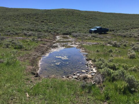
Conservation through Wet Meadows Projects
![]() CONSERVATION THROUGH WET MEADOWS PROJECTS
CONSERVATION THROUGH WET MEADOWS PROJECTS
by Cheryl Cwelich, Watershed Programs Coordinator
In the early morning light, the rolling sagebrush landscape is a soft green and grey against the pale blue of the sky. “Here’s some more Cheetos!” says restoration expert, Shawn Conner, using a colloquial term for the Gunnison sage-grouse roost pellets, which, indeed, resemble white cheddar Cheetos (though some people prefer calling them “dried dates”). All morning, we have been seeing Gunnison sage-grouse signs – pellets, tracks, feathers, and traces of dust baths.
The Gunnison sage-grouse, a medium-sized bird whose striking males have a bustle of long tailfeathers, a black mohawk, and a brilliant white chest with drooping yellow air-sacks; is federally listed as a threatened species. The Gunnison Basin is home to more than 85 percent of the species. To recover the species, the U.S. Fish and Wildlife Service has listed improving habitat quality and quantity as a priority one action. The Wet Meadows & Riparian Restoration Collaborative Program (Program) has been preserving, restoring, and protecting brood-rearing habitat for the Gunnison sage-grouse since 2012 using Zeedyk-style headcut and erosion control rock structures. U.S. Forest Service Wildlife Biologist, Darren Long, shared a fun fact with us: Gunnison sage-grouse practice geophagy, the practice of ingesting dirt. While earth-eating might work some of the time, wet meadows provide important food sources, like insects and herbaceous plants, for the chicks as they are growing. These mesic areas are also important to other migratory birds, big game, insects, other terrestrial and aquatic species, as well as to livestock for forage and private landowners for water resources.
Wet meadow and Gunnison sage-grouse habitat restoration has been happening at the U.S. Forest Service managed land on Flat Top Mountain since nearly the beginning of the Program – and it shows. The Gunnison sage-grouse are leaving their appreciation in the form of “Cheetos” all over the area. As Shawn, Darren, and myself walk the area to assess the restoration treatments, we come across several stock water ponds in other drainages. Most of them are dry. “Never seen that one dry before,” comments Shawn. With temperatures warming earlier and dust on snow contributing to sublimation, snowpack runoff in 2022 was not its best, leaving many pond and tank systems dry. Wet meadow systems help keep the sagebrush ecosystem resilient to drought – meaning floodplain connectivity, soil moisture retention, reduced erosion, and vegetation productivity.
Quantification research done by the United States Geological Survey has shown that natural rock detention infrastructure installed in eroded dryland stream beds in southeastern Arizona readily adapt to climate related stress. The study showed that these rock structures resulted in a 50 percent reduced average rate of flow especially in flash flood events, can sequester carbon at a rate of around 200-250 metric tons per hectare which is similar to coastal wetlands! These structures also extend the timing of summer base flows by 3 to 4 weeks, sequester soil at over 200 tons/year improving downstream water quality, support riparian vegetation and result in 28% more water flowing downstream compared to the control site, which means more water is kept in the system by developing a perched water table above bedrock .
The Upper Gunnison District hopes to conduct local research on improved base flows associated with wet meadow restoration in the near future. Flows that help wildlife leave more ‘Cheetos’ and over time hopefully help fill some of those empty stock water ponds.
If you would like to volunteer and for more information about the program, please contact Watershed Program Coordinator, Cheryl Cwelich: ccwelich@ugrwcd.org.
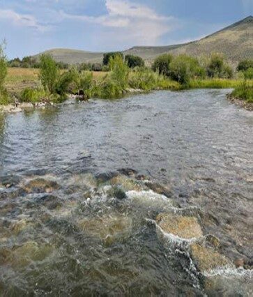
Sowing Seeds of Resiliency with Mark Tardiff
![]() Sowing Seeds of Resiliency with Mark Tardiff
Sowing Seeds of Resiliency with Mark Tardiff
As the monsoon clouds softly release some light raindrops, a hillside of colorful patches of Blue Flax, Showy Goldeneye, Yarrow, Scarlet Gilia, Showy Fleabane, Rocky Mountain Penstemon, and a wealth of other wildflowers sparkle in the cool morning. Intermixed with them are tall shoots of Western Wheatgrass, Slender Wheatgrass, and Smooth Brome in blues, greens, and browns. The display is rounded out with aromatic Big Sagebrush, Rabbitbrush, and Snowberry.
Tourists from all over the world travel to the Upper Gunnison River Basin to witness such beauty firsthand each summer, but all Mark Tardiff and Terre Mercier have to do is glance out their windows in Crested Butte South. When they built their home in 2017, they used the excavated rocks and small boulders that were dug up for their foundation to line the sides of their driveway creating retaining walls. On the hillside above these walls, they planted a mixture of wildflower seeds and native grasses for their landscaping.
“I’ve been interested in water since I was a small child playing in puddles, ponds and creeks, much to my mother’s dismay when I came home soaked and covered in mud,” said Mark Tardiff, now retired from working for over 40 years as a research scientist, mostly at the Department of Energy National Laboratories in Tennessee, New Mexico, and Washington state. “As stewards, we need to be a part of this landscape and not just on it. Over the last few decades, more people are awakening to the reality that climate change is real, and we all have a responsibility for conserving water, especially during our persistent drought.”
For his landscape, Mark researched drought resistant flowers and grasses and enlisted the advice of the Gunnison Conservation District to purchase a custom mix of native wildflower seeds and grass seeds from them which he sowed by hand on his property.
“I spent some time hand raking the construction scars and packed soil to loosen it up a bit and then sprinkled the seed by hand over all our areas of bare soil,” said Mark. “I used a rolled straw mulch product to help hold the seeds and soil in place and to absorb and hold water. I watered the seeds maybe once every three or four days for about three to four weeks just to get them to set in the ground and start germinating.”
Mark said that he planted the seeds in the fall so that they could soak up the moisture from the melting winter snowpack to start growing the following spring. Since their initial planting, Mark said he has never watered his property since, and that the xeriscaping requires almost no maintenance.
“In the spring, I take a weed whacker and spend maybe an hour total just cutting back the taller grasses and growth that have died over the winter and that’s it,” said Mark. “There’s no mowing, no weeding and no watering.” There’s also no fertilizers or herbicides, with the exception of Milestone to remove Canada Thistle which is an aggressive invasive plant that is almost impossible to remove otherwise.
Mark noted that it’s been really interesting to see the varying types and sizes of wildflowers and grasses that sprout up each year depending on how much snowpack accumulated over the winter and the prevalence of spring rains. Every year has been different. Patience is definitely a virtue when developing a natural landscape. It takes about five years for most of the plants to get established.
“Mother Nature knows how to adapt to drought conditions and temperatures,” said Mark. “Native plants and grasses tend to be very resilient as they’ve grown here for thousands of years. We just need to learn to work with Mother Nature to not obstruct her natural processes and protections.”
In addition to the drought resiliency qualities of his xeriscaping, Mark said it has also been a sanctuary for pollinators in the area, particularly hummingbirds and bees. Mark pointed out that the trumpet like blooms on the Scarlet Gilia are the perfect size and shape to fit the hummingbirds’ tiny beaks. Bees are especially attracted to Penstemons and the bright red Indian paintbrush, which Mark noted is a “hemiparasite” meaning that although it can photosynthesize, it also draws nutrients from other organisms, in this case, from the neighboring perennial grasses or Sagebrush. Like the pollinators, Mark said that deer and other wildlife are drawn to the xeriscaping.
On the opposite side of the Tardiff/Mercier property there is a small wetland area including an ephemeral small creek that runs through it in the early spring as the snow melts. In this area, there is a tall stand of aspen, Corn Lilies, Cow Parsnip and a variety of other wetland native plants and shrubs. Mark notes that with the steeper slope of this area, Mother Nature is again using the native flora to store water as long as possible throughout the warm, dry summer months. According to the US Forest Service, since aspen have moist green leaves and thick twigs, they do not burn easily, unlike conifers which have dry needles and may use three to seven inches more water per year than aspen.
“Water and elevation are everything in the West,” said Mark. This is why he encourages property owners to do some research and carefully consider what they plant on their property for the best resiliency and impact on the environment. “I am happy to share what I’ve learned with other property owners considering xeriscaping. I also highly recommend visiting the Gunnison Conservation District office. They have lots of experience with vegetating natural landscapes and are pleased to help you with seed selections and methods”
During Mark’s career as a research scientist, he studied first-hand how contaminants from historic land disposals can degrade groundwater and surface water quality and how these hazardous environments can affect our well-being and impact our natural resources. Because of this, he has made a commitment to conserve water, reduce carbon emissions, and participate in initiatives to become a community in a carbon neutral county, state, and nation.
Mark is currently running for a seat on the Crested Butte South Property Owners Association (POA) where he seeks to preserve “a weird and wild rural Rocky Mountain lifestyle.” Mark intends to keep environmental issues in the discussion mix as the POA makes decisions that influence future development.
“I will be a voice for the values we share that drew us here,” said Mark. “While the forces of change for both the environment and our built human communities are daunting, we need to remember who we are.”
As such, Mark will just keep sowing the seeds of resiliency for the beauty and protection of our basin.
![]()
![]()
![]()
Julie Nania UGRWCD Board Member Profile
![]()
Julie Nania was appointed to the UGRWCD Board of Directors in June 2017 representing Division 5, Crested Butte. Her current term, her second, expires in 2025. Julie serves as the High Country Conversation Advocates water director, a position she has held since 2014 when she relocated to Crested Butte. Prior to her move, Julie spent three years as faculty at the University of Colorado through appointments with the Cooperative Institute for Research in Environmental Sciences (CIRES) and Colorado Law’s Getches-Wilkinson Center for Natural Resources, Energy and the Environment. Her work at the University involved collaborating with a range of local communities to address natural resources and climate issues. She graduated from University of Colorado School of Law in 2011 and received her B.A. in International Studies from the University of Washington in 2007.
Julie said she was “strongly encouraged” to pursue a seat on the District’s Board of Directors by former Board member Steve Glazer. “At first, my interest in serving was piqued by a remarkable representation of folks in water that I really respect and wanted to learn from,” said Julie. “Steve Glazer was on the District Board at the time and lectured me on the important role the District has in managing water resources for the water users of this valley…He was a fascinating force of nature!” Sadly, Steve passed away in 2016 after serving 17 years on the District Board.
As the water program director at High Country Conservation Advocates, Julie works to protect the state’s rivers by identifying and advocating for designation as “outstanding natural resource waters” and recommending rivers for protection through the forest planning process. She also directs stewardship projects to improve watershed health and restore riparian habitats. Finally, she consults with municipalities to advance water efficiency, water quality and conservation efforts.
“My goal is to maintain, and if at all possible, improve the health of our ecosystems while continuing to protect our watershed for all water users,” said Julie. “I realize this is a lofty goal as with an increase in population, there comes a set of sacrifices for us all to be able to continue to live, play and sustain a livelihood in our valley.”
Julie noted that the District Board is at a critical crossroads of planning watershed management strategies for a future of continuing drought conditions, more extreme temperatures and weather, earlier snowmelt, dust on snow and increased development in the Gunnison River Basin. In spite of these challenges, Julie said she is excited about the opportunity to work within the legal system and come up with creative solutions to address how to effectively manage the needs of conflicting users competing for the same resource.
“I think we will need to grow our lens from just looking at traditional water uses to zoom out to the bigger picture of all ecosystems and how we need to adapt to ensure their survival for the future,” said Julie.
Julie said she is proud that the District has been proactive, especially in the last few years, about assessing watershed health and how that impacts our water users. “It’s not just about who is using what water, it is about how the system works as a whole and how changes in our climate and environment impact the system as a whole.”
When Julie is not on the river studying its ecosystems, she and her husband, Dan Loftus, who were just married this spring, love to be on any river just relaxing and enjoying the beauty and life force of the water. “Dan is a wonderful husband who is a huge river enthusiast,” said Julie. “In fact, one of our first dates was on the Taylor River for a Taylor Tuesday event. We also have two wild rescue dogs who join us on our adventures and love to shred and ski with us on the frozen form of our water.”
UGRWCD General Manager Sonja Chavez noted that Julie has played such an important role on the District Board in helping the District understand and stay abreast of conservation and water issues in the basin. “Julie has been an invaluable asset to the District,” said Sonja. “With her legal background in big river issues and federal reserve water rights and the fact that she has her boots on the ground on a daily basis observing our watershed and ecosystems, she comes to the Board with a wealth of knowledge and experience that is so important and helpful in meeting the District’s mission.”
UGRWCD Receives Drought Funding from Bureau of Reclamation
UGRWCD RECEIVES FUNDING FROM BUREAU OF RECLAMATION FOR DROUGHT PLANNING
The Upper Gunnison River Water Conservancy District (UGRWCD) has been awarded funding from the Bureau of Reclamation for the development of a drought contingency plan. UGRWCD General Manager Sonja Chavez said, “Being at the headwaters of the Colorado River Basin, we see and feel first-hand, the pain of the effects of on-going drought on all our water users. We look forward to working proactively with our community to come up with a drought response program plan that when implemented, increases our water supply reliability and resiliency to drought.”
![]()
Reclamation approves $865,480 to five western states for drought contingency planning grants to improve long-term drought resiliency
Media Contact: Chelsea Kennedy 702-280-2824 ckennedy@usbr.gov
For Release: Aug 2, 2022
As the western United States faces unprecedented severe drought conditions, the Bureau of Reclamation is announcing the award of six drought planning activities for 2022 WaterSMART: Drought Contingency Planning grants. This program provides federal cost-share funds for entities to develop and update comprehensive drought plans, employing a proactive approach to build long-term resiliency to drought.
“The American West is experiencing a historic drought, fueled by climate change,” said Assistant Secretary for Water and Science Tanya Trujillo. “These projects are part of the Department’s strategy to tackle the long-term challenge of climate change – while we take emergency actions to address immediate challenges, we are investing in our communities to develop measures to improve long-term drought resiliency”
“Supporting drought planning efforts is an essential part of maintaining and modernizing our nation’s water infrastructure and promoting drought resiliency, water security, and climate change adaptation,” said Deputy Commissioner of Operations David Palumbo. “With the current state of persistent drought in the West, these grants will help support communities in planning for their future water use.”
The selected projects support drought planning development and updates to help meet the unprecedented drought conditions in the West. These projects will support these communities in building drought resiliency by planning for and preparing for drought through monitoring and prioritization of mitigation and response actions to protect vulnerable resources during times of drought.
Arizona
- City of Kingman, located in Mohave County, Arizona, will use $100,000 in federal funds to develop a new drought contingency plan. The plan will improve water supply reliability for the City of Kingman that currently utilizes groundwater from the Hualapai Basin and is experiencing exceptional and unprecedented drought conditions. Total Project Cost is $200,000
California
- Three Valleys Water Municipal District, in Eastern Los Angeles County, will use $200,000 in federal funds to develop a new drought contingency plan. Three Valleys Water Municipal District has had severe restrictions to portions of its service area. The new Drought Contingency Plan will address the region’s concerns with drought and leverage existing and in-progress member agency planning efforts. Total Project Cost is $400,000
Colorado
- Uncompahgre Valley Water Users Association, in Montrose, Colorado will use $200,000 in federal funds to develop a new drought contingency plan to evaluate new approaches for water shortage contingency plan actions, review climate conditions, and develop a response framework for irrigation and municipal deliveries during future drought conditions. Total Project Cost is $400,000
- Upper Gunnison River Water Conservancy District, in Gunnison, Colorado will use $140,480 in federal funds to develop a new drought contingency plan to address extended drought, build long-term resilience in the basin, and provide a framework for sustainable water management. Total Project Cost: $306,620
New Mexico
- City of Roswell, located in Chaves County, New Mexico, will use $200,000 in federal funds to develop a new drought contingency plan to increase their water reliability and improve water management through conservation, expanded technologies, and improved modeling capabilities. This planning effort will work in tandem with Roswell’s 2021 Water Conservation Plan. Total Project Cost: $400,000
Oregon
- Santiam Water Control District in Stayton, Oregon will use $25,000 in federal funds to update their existing drought contingency plan to address emerging concerns, improve the drought monitoring process, incorporate new mitigation actions, and streamline the operational and administrative framework and plan update process. Total Project Cost: $50,000
For more than 100 years, Reclamation and its partners have developed sustainable water and power solutions for the West. These grants are part of the Department of the Interior’s WaterSMART Program which focuses on collaborative efforts to plan for and implement actions to increase water supply reliability. Reclamation continues focus on short- and long-term actions to respond to the historic drought conditions across the West, using existing authorities and partnerships to provide immediate relief while investing in infrastructure and research opportunities to build climate resiliency and find innovative strategies to address future hydrologic changes due to climate change.
For more information about the program, please visit Drought Response Program website.
If you would rather not receive future communications from Bureau of Reclamation, let us know by clicking here.
Bureau of Reclamation, Denver Federal Center, Alameda & Kipling Street PO Box 25007, Denver, CO 80225 United States
High Country Anglers reports on “Trout Health Beyond the Water’s Edge”
![]()
“Trout Health Beyond The Water’s Edge” from High Country Angler
Healthy trout rely on healthy rivers! Read more about how the Upper Gunnison Watershed is taking a holistic approach to conservation. Nancy Johnston Bramlett reports on these efforts in High Country Angler here:
Living Dangerously on the Colorado River at CB Public Forum
![]()
The Upper Gunnison River Water Conservancy District encourages everyone to attend the Crested Butte Public Policy Forum on Tuesday, August 16, 2022 from 7 to 8:30 p.m. at the Center for the Arts where Anne Castle will present “The Years of Living Dangerously on the Colorado River.”
The Colorado River has been called the hardest working river in United States, part of the legendary landscape of the West and sadly, now one of the most precious resources threatened by climate change and development. Ms. Castle will provide a personal, in-depth overview of how governments, stakeholders and environmentalists are all seeking viable solutions.
Anne Castle served as assistant secretary for water and science in the U.S. Department of the Interior from 2009 to 2014. While at the Interior, Castle spearheaded the Department’s efforts to provide federal leadership and funding to support sustainable water supplies, including the development of sustainable hydropower. She is currently a senior fellow at the Getches-Wilkinson Center for Natural Resources, Energy and the Environment, part of the University of Colorado-Boulder School of Law. She has provided hands-on leadership for a variety of critical Colorado River issues. As a self-proclaimed “recovering lawyer,” Castle practiced water law for over 28 years and has served on numerous water-related Boards and committees, including the Colorado Water Trust and Stanford University’s “Water in the West” program.
The Crested Butte Public Policy Forum is free to the public, thanks to its generous sponsors.
UGRWCD Helps with 4-H Camp
UGRWCD HELPS WITH 4-H CAMP AT GUNNISON COUNTY FAIRGROUNDS
Over two dozen kids from age 8-18 enjoyed the overnight 4-H Camp June 15th and 16th at the Gunnison County Fairgrounds. This year’s camp theme was “Every Drop Counts” and campers got to experience what happens in a watershed when topography, people, or climate change affect the flow of streams and rivers through the hands-on experiential “water trailer.” In addition, campers participated in a variety of workshops, participated in “Ag Olympics,” practiced the art of showmanship and tie dyed t-shirts.
“It was a full two days of activities and I was happy to see so many smiling faces,” said Perri Pelletier, Gunnison County Extension Agent for 4-H Youth Development. “I think the campers had a lot of fun but also learned what an important resource water is to us all. We are grateful to the Upper Gunnison River District and Gunnison County Electric for helping make this experience possible.”
The Upper Gunnison River Water Conservancy District’s funding was part of the District’s “Education and Outreach” programming. For more information about the District’s mission, please visit www.ugrwcd.org or call (970)641-6065. For more information about 4-H, please contact Perri Pelletier at (970)641-7630.


UGRWCD Supports Headwaters Radio Series
DON’T MISS THE “HEADWATERS” SERIES FEATURED ON KBUT PUBLIC RADIO
Most would agree that WATER is the Upper Gunnison River Basin’s most important and valuable resource. Whether it’s falling as snow in the mountains, rushing down rivers and streams, or stored in large buckets called reservoirs – water is essential in more than one way to everyone who lives here. It’s also important for the 40 million people who rely on the 1,450-mile Colorado River. Listen to Headwaters, a five-part series, that dives into what it means to be a headwaters community in the Colorado River Basin at a critical – and pivotal– time for water in the West.
This series was reported and produced for KBUT by Stephanie Maltarich with editorial support from Chad Reich. The series was made with support from The Water Desk, an initiative of the Center for Environmental Journalism at the University of Colorado Boulder. Additional support from the Center for the Arts 2022 Writer in Residence program and Upper Gunnison River Water Conservancy District. Specifically, the District paid for a mini grant to create the “Headwaters” artwork seen below. Jennie Noreen Omasta was commissioned to create the artwork to market the radio series. Jennie was raised in the Gunnison Valley.
The reports will run live during Morning Edition every Wednesday in June (1, 8, 15, 22, 29). If you’ve missed any or would just like to listen again, all of the series will be available at www.kbut.org/headwaters.
District funding was provided through the “Mini-Grant Program” which supports educational outreach about the Upper Gunnison River Watershed. For more information on the Mini-Grant Program, please contact the District at (970)641-6065 or visit the tab under the Projects & Programs link on this website.


Colorado River Compact Part 2
![]()
Can the Law of the Colorado River Adapt to an Increasingly Drier Hydrology?
A Two-Part Article by John McClow, UGRWCD Legal Counsel
PART 2 – Colorado River Compact
Adapting the Law of the River for a Dry Hydrology
Lake Powell storage levels began declining in 2000, and by the end of 2004 were at an alarmingly low elevation. As a result, the Upper Basin States requested that the Secretary of the Interior reduce releases from Lake Powell. Instead, she ordered the seven Colorado River Basin States to work with the Bureau of Reclamation to agree to address reservoir operations in dry hydrology. The parties complied, and the result is the Interim Shortage Guidelines, embodied in a Record of Decision signed by the Secretary of the Interior in 2007, which will remain in effect through December 31, 2025 (2007 Guidelines). The 2007 Guidelines provide for coordinated operation of Lake Powell and Lake Mead during the Interim Period, the objectives of which are to avoid curtailment of uses in the Upper Basin, minimize shortages in the Lower Basin and not adversely affect the yield for development available in the Upper Basin. Annual releases from Lake Powell are determined according to storage levels in Powell and Mead so that equalization of storage in the two reservoirs can be achieved as nearly as practicable each year. The Guidelines establish the conditions under which the Secretary of the Interior will declare a shortage in the Lower Basin and apportions the shortage between Arizona and Nevada. The 2007 Guidelines were the beginning of a new era of collaboration among the seven Colorado River Basin States and Reclamation to address the need to adapt the Law of the River to historically dry conditions.
The 2007 Guidelines were moderately successful in meeting their objectives. Still, by Summer 2013, the extent of the 2012-2013 drought created concerns among Colorado River Basin water managers, including the Secretary of the Interior. All of the models reached similar conclusions: without adjustment to reservoir operations, there was a 20% probability that reservoir levels could reach critical levels within two years if current conditions continued. The seven states convened meetings of legal and technical working groups to develop a contingency plan to respond quickly to the models’ worst-case scenarios. The groups met with the states’ principals in early 2014 and presented a spreadsheet of possible actions for immediate drought response. It became clear that the solutions for the Upper and Lower Basins were sufficiently different that the groups should split and work on their plans separately, but with coordination between the Upper and Lower Basin teams. The result was a Drought Contingency Plan (DCP) for each Basin.
The Lower Basin DCP directs that as Lake Mead reaches lowering storage levels, the states must reduce their consumptive use of Colorado River water (called “taking shortages”) based on storage tiers contained in the 2007 Guidelines and supplemented by the DCP. The DCP also provides that California will also take shortages if Lake Mead declines to critical storage levels. Lake Mead storage has fallen to the point that in 2022 the DCP requires Arizona to take a shortage of 512,000 acre-feet and Nevada 21,000 acre-feet. The Lower Basin states announced the “500 Plus Plan” in December 2021. They pledged to collectively preserve 500 acre-feet of storage in Lake Mead in 2022 and 2023 – evidence of additional adaptation in response to the dry hydrology.
The Upper Basin DCP consists of three elements: (1) expand existing weather modification (cloud seeding) and phreatophyte removal; (2) extended operations of the upper CRSP reservoirs (Blue Mesa, Flaming Gorge, Navajo); and (3) development of a demand management program. Although its contribution is relatively small, the states have aggressively pursued the first element. To implement the second element, the Upper Basin States entered into a Drought Response Operations Agreement (DROA), which provides for additional releases from the upper CRSP reservoirs to maintain critical storage levels at Lake Powell. In July, the Secretary of the Interior exercised her emergency authority under the DROA to release 181,000 acre-feet from Flaming Gorge, Blue Mesa, and Navajo Reservoirs. The states and Reclamation are developing additional criteria for future releases under the DROA. Reclamation does not presently contemplate further releases in 2022. The Upper Basin States are heavily involved in evaluating the advisability and feasibility of the third element, a demand management program that contemplates voluntary, temporary, compensated reductions in consumptive use by Upper Basin water users of all types for compliance with the 1922 Compact.
In addition to the Drought Contingency Plans, the United States has negotiated supplements to the 1944 Treaty. Mexico has agreed to share shortages by taking reductions in its deliveries in amounts comparable to the shortages taken by the Lower Basin States under their DCP.
What Does the Future Hold?
Despite these significant collaborative efforts by the Colorado River Basin States and the Bureau of Reclamation to adapt the Law of the River to changing conditions, reservoir levels have continued to decline, so a significant challenge remains. As the states and Reclamation begin renegotiating the 2007 Guidelines – to further adapt to drier hydrology – all parties have pledged to continue collaborating on mutually beneficial solutions to address that remaining challenge. History indicates that they will succeed.
Rebie Hazard UGRWCD Board Member Profile Copy Copy
![]()
Rebie Hazard was appointed to the UGRWCD Board of Directors in June 2003 representing Division 2, Saguache County. Her current term expires in 2023. She is also a Board member of the Saguache County Planning Commission and serves on the Advisory Board for the Saguache County Master Plan. She has also served on the Colorado River Water Conservation District Board of Directors since 2005.
Rebie owns and operates the Flying M Ranch on Cochetopa Creek. In addition to being a working cattle ranch, the ranch also accommodates hunting and fishing enthusiasts. It has been in the Hazard family since 1916. Rebie’s great great grandfather settled with his family in the area in 1868 and Rebie’s grandfather was instrumental in the economic development of Saguache and an active player in the history of the area. Saguache is a Ute word that means “blue earth” or “water at blue earth” which is appropriate considering Saguache County is located in a high alpine valley with the second largest aquifer in the nation. Saguache prides itself on its fresh, clean water that they say rivals any bottled water since no chlorine or fluoride is added to their drinking water supply.
Rebie is the longest-serving member on the current UGRWCD Board of Directors. As such, she has seen a lot of changes in her 19 years of service. “I am very proud to see all that the District has accomplished during my tenure,” Rebie said. “Huge strides have been made in the Watershed Management Planning process as over 200 potential water improvement projects have been identified and prioritized and dozens of these have already been completed or are underway.”
Rebie is a member of the District’s Water Administration Committee, Grant Committee and the Finance Committee and has also witnessed the growth of resources in the District. “When I was appointed to the Board in 2003, the District had revenues of less than three quarters of a million dollars,” said Rebie. “Now, less than 20 years later, our revenues have almost tripled to nearly two and a quarter million dollars. I’m especially pleased how much of this has been leveraged to receive matching funds from other grantors and government agencies for improvement projects in our watershed.”
As a member of the Planning Commission for Saguache, Rebie understands the challenge of meeting the needs of our growing populations with limited water resources. “For the future, we have to figure out how to accommodate more people living and playing in this basin with less water than we have now,” said Rebie. “I believe with the proper amount of conservation and cooperation, we can responsibly use our limited water supply, but the District will have to be the leader in educating our population about changes to our way of life to make this possible.”
UGRWCD General Manager Sonja Chavez said she is very grateful for Rebie’s many years of service to the District. “Rebie has such a great understanding of the needs of the rural agricultural water users since she manages a working ranch,” said Sonja. “This coupled with the fact that she has such a long history with the Upper Gunnison District, the Colorado River District and with Saguache County is such an asset to our Board and the decisions we make. We are so appreciative of her knowledge and experience.”
When Rebie has a spare moment from her ranching responsibilities and her service to the various Boards she’s involved with, she enjoys collecting antiques and treasures from the Old West, fishing, hunting and spending time with her children and grandchildren.
2022 Grant Funding Announced
UGRWCD MAKES 2022 FUNDING ASSISTANCE GRANT AWARDS
![]() The Board of Directors of the Upper Gunnison River Water Conservancy District (UGRWCD) voted recently to award over $306,001 to organizations and individuals in the Upper Gunnison Basin for projects that will enhance water supply or improve stream conditions. Projects awarded included efforts to improve water system supply and efficiency, delivery structure or system improvements, restoring or enhancing riparian habitat, and addressing water quality. These were a diverse group of projects throughout the Upper Gunnison Basin. Here is a breakdown of project amounts awarded by sub-basin:
The Board of Directors of the Upper Gunnison River Water Conservancy District (UGRWCD) voted recently to award over $306,001 to organizations and individuals in the Upper Gunnison Basin for projects that will enhance water supply or improve stream conditions. Projects awarded included efforts to improve water system supply and efficiency, delivery structure or system improvements, restoring or enhancing riparian habitat, and addressing water quality. These were a diverse group of projects throughout the Upper Gunnison Basin. Here is a breakdown of project amounts awarded by sub-basin:
- Tomichi Creek $80,000
- Gunnison River $34,000
- Lake Fork $7,500
- Quartz Creek $12,000
- Slate River $40,000
- East River $26,071
- Ohio Creek $43,500
- Municipal $25,000
- Basinwide Projects $37,930
All recipients were required to provide a 50 percent cost match and their projects had to be consistent with the District’s purpose, mission, and objectives.
This year’s funding distribution the largest since the program originated in 2009.
“The Grant Committee was very impressed with the number and quality of the grant applications that we received this year,” said Sonja Chavez, general manager. “The District Grant program is a prime example of the District’s allocation of tax revenues as a direct benefit to water users in the District. Plus, I am delighted to report that these grant funds are being leveraged 3:1 from other sources through the required match.”
The UGRWCD Funding Assistance Program follows an annual cycle with applications due in February each year. If you have a water project in mind, please call the District at (970) 641-6065 to schedule a consultation.
Andy Spann UGRWCD Board Member Profile
![]()
Andrew “Andy” Spann was appointed to the UGRWCD Board of Directors in June 2016 representing Division 7, Gunnison River Basin. Andy’s current term expires in 2022, although Andy reports that he will be submitting a letter of interest to Judge Steven Patrick in hopes of serving another term on the Board.
The acorn didn’t fall far from the tree when it comes to involvement in water issues. Andy’s paternal grandfather, Lee Spann, served on the Upper Gunnison District (“District”) Board of Directors from May 1982 to June 1998. Andy’s father, Ken Spann, served on the District Board from July 2001 to June 2016. In addition, Lee served on the Colorado River District Board of Directors and Ken served on the Gunnison Basin Roundtable. Andy’s sister, Laura Spann, is the program coordinator for the Southwestern Water Conservation District (SWCD). Laura oversees the SWCD’s financial assistance program and Water Information Program, serves as an alternate for the district on the Water Congress State Affairs Committee, and monitors state water policy. She also serves on Water Education Colorado’s board of directors.
Andy’s maternal grandfather, John Porter was a board member of the Montezuma Valley Irrigation Company; Southwestern Water Conservation District; Colorado Water and Power Authority; Colorado Water Congress; Colorado Foundation for Water Education; Colorado Water Trust; and the seven-state Colorado River Water Users Association. He served on the San Juan/Dolores Basin Roundtable and Colorado Inter-Basin Compact Committee, and was a negotiator for the Colorado Ute Indian Water Rights Settlement Act of 1988. For 22 years, he managed the Dolores Water Conservancy District. He received many accolades for his water leadership, including the Colorado Wayne N. Aspinall Award, Water Leader of the Year in 2000, and the Citizen Award from the U.S. Bureau of Reclamation, as well as tribute from the Colorado House of Representatives in 2017.
“A lot of the conversations during our family get-togethers revolve around water issues,” said Andy. “As ranchers, we see firsthand the effects drought and climate change have on our operations, particularly with respect to water availability.”
Andy was born and raised in Gunnison where his family has ranched for six generations since 1878. Following his high school graduation, Andy attended Colorado State University in 2005 to study agricultural science and crop production. Andy’s interest in mechanics drew him to transfer to Wyotech College in Laramie, WY where he earned his associates’ degree in chassis fabrication and high performance engines. Andy returned to the Gunnison Valley and has been working full-time on his family’s ranch for over a decade.
Andy said that climate change and the past 20 years of dry conditions, which scientists are now terming a “megadrought,” unfortunately means the Spann Ranch, which has been in the family for six generations now, will likely not be able to continue doing business as usual.
“With diminishing snowpack and a shortened or nonexistent monsoon season, our pastures just can’t support the number of cattle we’ve traditionally fed,” said Andy. “Like most ranchers in the Gunnison Basin, we are going to have to adapt our operations.”
Andy serves as a member of the Grant Committee, Legislative Committee and Water Administration Committee for the UGRWCD Board. In addition, he serves as the agriculture representative on the Taylor Local Users Group, which was established to provide recommendations to the Bureau of Reclamation on operational flow releases from Taylor Park Reservoir.
“Being a TLUG representative has been one of the most challenging and yet important responsibilities I have assumed for the District,” said Andy. “It is a diverse, vocal group of individuals who all have a vested interest in water released from Taylor Reservoir. In spite of our different water user perspectives, I think the group as a whole has done a commendable job of reaching a consensus that best serves the interests of all water users while also taking into account that we’re dealing with a limited resource that has also been affected by climate change.”
Andy said that he sees one of the biggest challenges for the District going forward is the proper management and allocation of water during these times of drought and population growth. “Agriculture has deep roots in the history of this valley, and I hope it can continue to be a driver in our economy,” said Andy. “But as climate change, development and increased population put pressure on our watershed, we are all going to have to learn to adapt, cooperate and come up with creative solutions to sustain our way of life.”
“Director Spann is such a valuable asset to our organization for many reasons, but most importantly because of his history in this basin and his agricultural experience and knowledge of the water resources in this area,” said Sonja Chavez, general manager of the UGRWCD. “We couldn’t be more grateful that he chose to continue carrying on his family’s water legacy.”
With Andy’s long hours working on the family ranch and attending District Board and committee meetings, he doesn’t have much spare time, but in those rare moments when he can get away, he enjoys spending time with his wife, Megan, and daughters, Parker and Layne, as well as hiking, hunting, snowmobiling and fishing. An avid horseman, Andy is also a member of the Gunnison Stockgrowers Association.
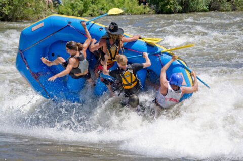
Gunnison River Festival Announces 20th Anniversary and NEW Events
JUNE 10-12, 2![]() 022 – GUNNISON RIVER FESTIVAL TO CELEBRATE 20TH ANNIVERSARY AND NEW EVENTS!
022 – GUNNISON RIVER FESTIVAL TO CELEBRATE 20TH ANNIVERSARY AND NEW EVENTS!
The 20th Anniversary of the Gunnison River Festival will be celebrated June 10-12, 2022. There will be three great days of “Celebrating the Rivers” of the Upper Gunnison Basin, including the favorite Taylor Downriver Raft and Kayak races, new educational seminars, dry land and in-flow clinics, and the return of the popular whitewater events and Hooligan Race, where participants create their own rafts hoping they will float through the Gunnison Whitewater Park.
“We are so excited to be able to mark this milestone by returning to a full-fledged river festival, including some of the popular events that were held at the very first River Festival,” said Joellen Fonken, director of the Gunnison River Festival, a nonprofit organization whose title sponsor is the Upper Gunnison River Water Conservancy District.![]()
Joellen noted that it’s been fun to go back through the historical records and see how the river festival has grown and evolved over the years. “We are looking forward to having Bob Jones and some of his original festival cronies involved in this year’s anniversary celebration. All of us involved with the festival are proud and gratified to see how it has grown in numbers and served to educate so many individuals about the significance of our watershed,” said Joellen.
![]()
NEW THIS YEAR!
In addition to a full slate of activities for the actual Gunnison River Festival, this year residents and visitors to the area also got to spruce things up to get ready for the June festival.
On Saturday, April 23rd, the UGRWCD and Gunnison River Festival partnered with the City of Gunnison and Western Colorado University to help with the Community and River Clean-Up Day. The District would like to thank the volunteers who braved the cool, windy conditions to help pick up trash along sections of the Gunnison River and Tomichi Creek and clean-up brush and debris along the banks. For their efforts, the volunteers were treated to a “taco for trash” compliments of the UGRWCD. Pulled pork tacos were served by 5 B’s BBQ at Jorgensen Park to the wonderful volunteers who diligently brought back their filled trash bags. The District hopes to team up with the City and Western again next year for the Community and River Clean-up, which takes place annually in honor of Earth Day. Hope you can join us next April!
On Thursday and Friday, June 9 and 10th, the UGRWCD will host its first annual Upper Gunnison Basin Water Roundup, a conference bringing together water experts to share their collective knowledge with each other but most importantly with the general Upper Gunnison basin community water user. The conference will include various presentations from experts in forest and watershed health, wildfire risk assessment, drought, wet meadows and riparian restoration, sage grouse habitat restoration, broader Colorado River basin issues, and the annual Colorado River District’s State of the River presentation. The conference will be held at the I-Bar Ranch and Event Center located just 250 feet from Tomichi Creek at the base of W Mountain just east of Gunnison. Conference participants will have the opportunity to camp at the I-Bar for the conference and are encouraged to stick around the I-Bar Friday evening, June 10th for a concert by Grammy-nominated reggae pioneers, The Wailers, and traditional Jamaican food catered by Jermaines. “This concert will be a great way to wrap up the last day of the conference and the first day of the festival,” said Joellen.
For a complete schedule of Gunnison River Festival events, please visit https://www.gunnisonriverfestival.com/schedule/ as events and festivities are still being added to the schedule. You can also check out the UGRWCD’s website at www.ugrwcd.org/water-roundup and our Facebook and Twitter pages for regular updates.
Spring 2022 Newsletter
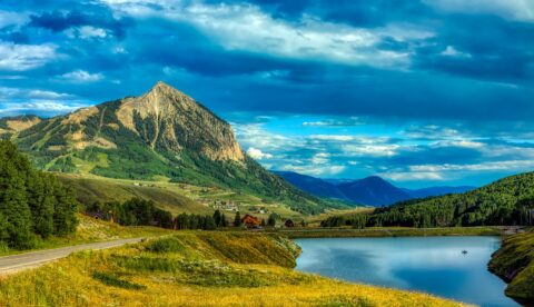
Colorado River Compact Part 2
Can the Law of the Colorado River Adapt to an Increasingly Drier Hydrology? A Two-Part Article by John McClow, UGRWCD Legal Counsel PART 2 –
2022 Grant Funding Announced
UGRWCD MAKES 2022 FUNDING ASSISTANCE GRANT AWARDS The Board of Directors of the Upper Gunnison River Water Conservancy District (UGRWCD) voted recently to award over
Andy Spann UGRWCD Board Member Profile
Andrew “Andy” Spann was appointed to the UGRWCD Board of Directors in June 2016 representing Division 7, Gunnison River Basin. Andy’s current term expires in
Gunnison River Festival Announces 20th Anniversary and NEW Events
JUNE 10-12, 2022 – GUNNISON RIVER FESTIVAL TO CELEBRATE 20TH ANNIVERSARY AND NEW EVENTS! The 20th Anniversary of the Gunnison River Festival will be celebrated
Save the Date for 2022 Gunnison River Festival
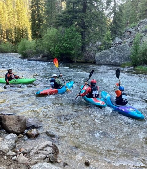
JUNE 10-12, 2![]() 022 – SAVE THE DATE FOR THE GUNNISON RIVER FESTIVAL!
022 – SAVE THE DATE FOR THE GUNNISON RIVER FESTIVAL!
It’s hard to believe it has been 20 years since Bob Jones and a class at Western State College (now Western Colorado University) created the first Gunnison Whitewater Festival, which would later morph into the Gunnison River Festival. That first festival included downriver raft floats and races, kayak demonstrations and clinics, biking and climbing events, live music, vendors and much more.
The 2022 Gunnison River Festival Board of Directors are just beginning to plan for the three-day 20th Anniversary of the Gunnison River Festival, and wanted to be sure folks are adding the dates to their calendars now.
“With the cancellation in 2020 and a scaled back festival in 2021 both due to Covid, we are more than ready and excited to have a full-blown festival with three days of events to celebrate its 20th anniversary,” said Joellen Fonken, director of the Gunnison River Festival.
Joellen said a full schedule of programming will be released in the Spring of 2022 but that she anticipates rafting, kayaking, a foot race and educational clinics throughout our watershed. Watch the festival’s website at http://www.gunnisonriverfestival.com for updates.
The Title Sponsor of the festival continues to be the Upper Gunnison River Water Conservancy District.
Anyone interested in volunteering for the festival can submit their contact information via email to the Upper Gunnison River Water Conservancy District at sue@ugrwcd.org or may call the District at (970)641-6065.
Colorado River Compact
![]()
Can the Law of the Colorado River Adapt to an Increasingly Drier Hydrology?
A Two-Part Article by John McClow, UGRWCD Legal Counsel
The Gunnison River is a major tributary of the Colorado River. The Colorado River Basin has suffered from drought conditions throughout the 21st Century. The two major reservoirs in the Colorado River System – Lake Mead and Lake Powell – are at historic and dangerously low storage levels. Locally, Blue Mesa Reservoir is a stark illustration of the effects of the current dry conditions. Scientists are warning that “drought” is a term that no longer applies because it implies a temporary condition from which the Basin will recover. A more accurate term is “aridification” because the conditions we have experienced during the past 20 years will continue – or worsen – for the foreseeable future, as hotter and drier conditions make matters worse. Recently published projections indicate that river flows may decline 20 percent by midcentury and 35 percent by the end of this century. There is debate about the causes of the decline, but little disagreement that it will continue to happen. Can the Law of the Colorado River – numerous compacts, federal laws, court decisions and decrees, contracts, and regulatory guidelines – founded on a 100-year-old Compact – adapt sufficiently to meet the challenge of aridification?
PART 1: A Brief Summary of the Law of the Colorado River
The foundation of the Law of the River is the Colorado River Compact, signed by the seven Colorado River Basin States and the United States in 1922. The Compact is a contract among the signatories ratified by the seven states and Congress and became state and federal law. The Compact divides the Colorado River Basin into an Upper Basin (Colorado, Wyoming, Utah, New Mexico) and a Lower Basin (Nevada, Arizona, California). It apportions to the Upper and Lower Basins the beneficial use of 7.5 million acre-feet of Colorado River water per year. It requires that the states of the Upper Basin will not cause the flow of the river to be depleted below an aggregate of 75 million acre-feet for any period of ten consecutive years – measured at Lee Ferry, the dividing point between the Basins. It also describes how the Basins will share water delivery to Mexico. The Compact contains no reference to “curtailment” or a “Compact call.”
In the 1928 Boulder Canyon Project Act, Congress authorized construction of Hoover Dam (Lake Mead) and directed that the 7.5 million acre-feet allotted to the Lower Basin under the 1922 Compact be apportioned: California, 4.4 million acre-feet; Arizona, 2.8 million acre-feet; Nevada, 300 thousand acre-feet.
The United States signed a treaty with Mexico in 1944 that guarantees an annual delivery of 1.5 million acre-feet of Colorado River water to Mexico. In 1948, the Upper Basin States signed the Upper Colorado River Basin Compact, which apportions the 7.5 million acre-feet allotted under the 1922 Compact: Colorado, 51.75 percent: Utah, 23 percent; Wyoming, 14 percent; New Mexico, 11.25 percent. The 1948 Compact created the Upper Colorado River Commission (UCRC), consisting of a Commissioner appointed by the Governor of each state and a federal Commissioner appointed by the President of the United States. It also provides that if curtailment of use in the Upper Basin is necessary to maintain the flow at Lee Ferry required by the 1922 Compact, the UCRC will determine each state’s extent and timing of curtailment. It is important to note that neither the 1922 Compact nor the 1948 Compact affect water right administration within the states. In Colorado, that authority remains vested in the State Engineer.
In 1956, Congress passed the Colorado River Storage Project Act. The Act authorized construction of the reservoirs, dams and power plants of the initial units of the Project: Wayne N. Aspinall (originally the Curecanti Unit), Flaming Gorge, Navajo (reservoir and dam only), and Glen Canyon (Lake Powell), along with numerous participating projects, “making it possible for the States of the Upper Basin to utilize, consistently with the provisions of the Colorado River Compact, the apportionments made to and among them in the Colorado River Compact and the Upper Colorado River Basin Compact, respectively.” The CRSP power plants are an important source of hydropower in the Western United States, and the revenue from the sale of that hydropower supports operation of the Project and important salinity control and endangered fish recovery programs.
The Colorado River Basin Project Act, passed by Congress in 1968, authorized construction of the Central Arizona Project, which can divert 1.5 million acre-feet from the Colorado River to central and southern Arizona. Construction of the CAP allowed Arizona to develop its full apportionment of Colorado River water. The Act confirms California’s senior priority to 4.4 million acre-feet of Colorado River water, meaning that Arizona and Nevada must bear any shortage in the Lower Basin.
Next Issue: PART 2: Adapting the Law of the River for a Dry Hydrology
Cheryl Cwelich Joins UGRWCD Staff
![]()
Cheryl Cwelich joins the UGRWCD staff as the Watershed Program Coordinator, which involves leading all aspects of the collaborative Wet Meadow Restoration-Resilience Project, as well as providing technical and managerial assistance on a variety of environmental, recreational, agricultural, and municipal water projects for the District..
By Cheryl Cwelich
Bubbling. Trickling. Flowing. Water has been a draw on me since I was a wee thing. If I wasn’t creating waterfalls and ponds to my father’s chagrin in the backyard, then I was flustering my mother by splashing around and catching crawdads down at the “creek park.” Plus, there were the sunny (and rainy) days boating with my family on Lake Dillion and Cherry Creek Reservoir, falling out of a rafts on the Arkansas River, and being fascinated by ditches and pipes moving water around the local community farm. I was always playing with water.
During a stint as a seasonal park ranger at the Arkansas Headwaters Recreation Area for Colorado Parks and Wildlife, I was introduced to water management, both on the job and during their 20-year management planning effort. I was hooked. Transmountain water diversions, recreational flows, in-stream flows, fish habitat, carrying capacity, buy-and-dry and more. It was a revelation and I wanted – I needed – to know more. After perusing various schools, I chose Western Colorado University as the best comprehensive education to help me finish a degree in Environment & Sustainability with a focus on Water Policy & Resilience and a minor in Recreation & Outdoor Education. It was a great choice. Small classrooms, engaging professors, a lively community, and water resource conflicts kept me happily on-the-go. Plus, I got to live in Gunnison, where long ago, I learned to fish with my grandfather at the town pond.
While finishing school, I was intent on getting a water job to gain experience. My first summer, I worked as a reservationist with Scenic River Tours while healing from a knee injury. That fall, I walked into the Upper Gunnison River Water Conservancy District and they let me work as an intern, which included assisting with the Wet Meadow Restoration and Resiliency Building Project and helping with NRCS snow surveys. The last three years, I worked at the Crested Butte Land Trust (CBLT) as a river steward, educating river users on boating etiquette, respecting wildlife and private property, and conducting annual river recreation use studies. I finished my time at the CBLT as a stewardship and operations specialist overseeing various stewardship projects, including updating infrastructure on the historic Rozich ditch, mitigating beaver conflicts and launching a community farm project with partners. Today, I put days in ski patrolling up at Monarch Mountain to keep my eye on water storage, and ski the fluffy stuff.
The Gunnison valley is so special to me. It is a place of nostalgia, adventure and perseverance. I couldn’t be more ecstatic and honored to work for this community and her waters. The Wet Meadow Restoration and Resiliency Building Project is an incredible effort of numerous public and private stakeholders to protect her wildlife and “re-wet the sponge.” I am in humble awe of the hard work and planning that came before by numerous dedicated people in the BLM, USFS, CPW, CNHP, UGRWCD, and many, many more. It is a great joy to join the Upper Gunnison River Water Conservancy District to serve and protect what I like to call the water towers of the west. Then I can keep playing in the water, skiing on frozen water, boating on whitewater, drinking clean water and protecting rural water.
Winter 2021-2022 Newsletter
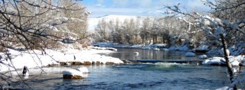
Andy Spann UGRWCD Board Member Profile
Andrew “Andy” Spann was appointed to the UGRWCD Board of Directors in June 2016 representing Division 7, Gunnison River Basin. Andy’s current term expires in
Save the Date for 2022 Gunnison River Festival
JUNE 10-12, 2022 – SAVE THE DATE FOR THE GUNNISON RIVER FESTIVAL! It’s hard to believe it has been 20 years since Bob Jones and
Colorado River Compact
Can the Law of the Colorado River Adapt to an Increasingly Drier Hydrology? A Two-Part Article by John McClow, UGRWCD Legal Counsel The Gunnison River
Cheryl Cwelich Joins UGRWCD Staff
Cheryl Cwelich joins the UGRWCD staff as the Watershed Program Coordinator, which involves leading all aspects of the collaborative Wet Meadow Restoration-Resilience Project, as well
UGRWCD’s Sonja Chavez urges action now
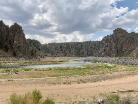
UGRWCD’s General Manager Sonja Chavez and other water leaders urge for conservation action now to avoid future demands from down-river states. The following article was published in The Colorado Sun and was written by Michael Booth.
New projections for low Colorado River flows speed need for dramatic conservation
Conservation groups say revised Bureau of Reclamation predictions are welcome realism showing Colorado needs to save water now.
A new federal system for projecting Colorado River water flows in the next two years confirms dire news about drought draining the West’s key reservoirs, and increases pressure on Colorado to conserve water immediately to avoid future demands from down-river states, conservation groups say.
The federal Bureau of Reclamation’s new system for projecting vital Colorado River flows in the next two years drops earlier, wetter years out of the historical reference, and gives more weight to two recent decades of drought. The regular October update this week shows water runoff into Lake Powell, the storage basin for four Upper Colorado Basin states, was only 32% of average for the 2021 water year, which runs from October to September.
The new projections for the next two years show that even with federal officials draining portions of Blue Mesa, Flaming Gorge and Navajo reservoirs to get more water to Lake Powell’s hydroelectric generating station, a moderate winter would leave the Colorado River in the same crisis a year from now. And a low-water scenario this coming winter season would drop Lake Powell well below the minimum level required to generate electricity by November 2022.
In addition to federal officials trying to protect hydroelectric generation at Lake Powell, and at Lake Mead as the downstream water bank for the Lower Basin states, water compacts govern how much Colorado River water needs to go downstream for use by agriculture and cities.
Colorado and the other Upper Basin states of Wyoming, Utah and New Mexico are required under interstate compacts to deliver 7.5 million acre feet of water a year into Lake Powell, in a 10-year rolling average. If enough bad water years ruin that average under the compact, Colorado must find water to send downriver to Nevada, Arizona and California — and 80% to 85% of Colorado’s available water is used for agriculture. The great majority of Upper Basin water originates from Colorado’s high country snowpack.
“We don’t have any more time to talk about it,” Matt Rice, co-chair of the Water for Colorado Coalition and Director of American Rivers’ Colorado River Basin Programs, said after reviewing the latest Bureau of Reclamation update.
Starting with the October update, the bureau begins the historical average calculations in 1991, instead of the 1981 cutoff used until now. The 1980s were much wetter in the Colorado River Basin, Rice said.
“These projections are worse than they have been in the past, but they’re also more realistic,” Rice said. Many conservation groups find that a positive step despite the bad news, Rice added, because it increases pressure on state water officials, local water conservancy districts, agriculture interests, cities and environmentalists to work faster on solutions.
At the same time, Rice said, the updated numbers should drive home the reality that there is 20% less water available now in the Colorado River than as recently as 2000. “There’s no more flexibility in the system, right? We’re looking over the edge of the cliff.”
Water conservation experts in Colorado have worked for years to avoid their worst-case scenario, which is a “call” or a sudden demand from federal managers to deliver more water for hydropower or to satisfy the compacts with the Lower Basin. Without advance planning, a call would force the state water engineer and local conservancy districts to cut irrigators’ water rights based only on the seniority of their water-use rights.
While state and local officials have been working with nonprofits on conservation plans, there are legal tangles that could require new legislation, and seemingly endless ethical questions about which parts of the state would suffer the most water loss, said Sonja Chavez, director of the Upper Gunnison River Water Conservancy District.
Blue Mesa Reservoir in her region has been nearly drained by drought and by federal officials taking extra from Western reservoirs to solidify Lake Powell’s power pool. Blue Mesa is projected to soon be down to 27% full, Chavez said. Blue Mesa was 33% full in mid-September, according to Bureau of Reclamation records.
State and private officials have cooperated to experiment with “demand-management” programs, where instead of buying agriculture land and its accompanying water rights outright, they buy the right to rent the water for a few years out of a decade. That rented water can be sent downstream in dry years, and in theory the restoration of water in other years should preserve the farm or ranch land while providing income for the farmer.
But renting or buying of water rights on the scale to meet compact demands would require hundreds of millions of dollars, with no current pot of money to pull from, water experts say. Colorado officials have mentioned the possibility of using money from the infrastructure stimulus plan currently under debate by Congress, but it’s uncertain whether the bill will pass, and how much water-related money will be in it if it does.
“There are a lot of questions that really haven’t been resolved,” Chavez said. “Who are the cuts going to come from? How’s it going to be distributed equitably? Who’s going to shepherd that water?”
Gunnison officials have also spent much time and energy to protect the sage grouse, a threatened species, Chavez noted. If a statewide demand management program sought across-the-board cuts, and “if we got rid of 10% of our wet meadows, how does that impact the bird?” she asked.
The largest amounts of water to be conserved are in agriculture, by far, but Front Range residents must be part of the statewide discussion about finding more water for the downstream Colorado River, Rice and Chavez said.
“You’re not going to get as much out of a city compared to what is the amount of irrigation water diverted for agriculture,” Chavez said. “But there’s also agriculture on the Front Range that benefits from our transmountain diversions,” some of which are created and controlled by urban water departments. “That has to be part of the picture.”
Volunteers Are Restoring Vital Wetlands
Using rocks, wooden posts, willow branches, and other locally-sourced natural products, volunteers are successfully restoring wetland habitat near Gunnison. After decades of erosion, ecosystems are being revived for the benefit of plant and animal species that call these wetlands home. KVNF Radio’s Laura Palmisano recently interviewed project volunteers. LEARN MORE HERE
Fall Newsletter 2021
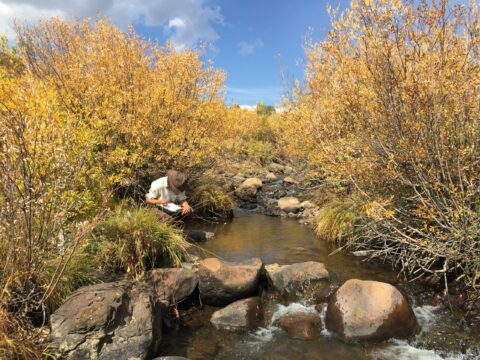
Grant Program to Improve Our Water
The UGRWCD’s Grant Program, which began in 2009 with a handful of applications, has now grown where the District annually receives 15-20 applications for a
John Perusek UGRWCD Board Member Profile
John Perusek was appointed to the UGRWCD Board of Directors in February 2018 representing Division 8, the City of Gunnison. John currently serves as the
It Takes A Community
It started as a grant application to the Upper Gunnison River Water Conservancy District (UGRWCD) from an area agricultural producer who wanted to improve
Easy Money Through Mini-Grants
At the UGRWCD, we believe that most residents of our District understand the importance of responsible water use and water conservation, but sometimes an educational
Grant Program to Improve Our Water
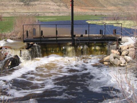
The UGRWCD’s Grant Program, which began in 2009 with a handful of applications, has now grown where the District annually receives 15-20 applications for a wide variety of water projects. Since its inception in 2009, the District has awarded $1.6 million to individual and organizational applicants. Last year, the District received 18 applications of which 13 were funded to the tune of just over $191,000.
As part of its mission to “accomplish the greatest possible use for irrigation, domestic, municipal, industrial, mining and all other purposes,” the grant program was formalized in 2009 to serve as a means of providing financial assistance to persons or entities advancing projects that enhance water supply and stream conditions within the District. Proposed projects must address one or more of the following criteria to be eligible for the grant program: (1) Development of a new water supply; (2) Improvement of an existing water supply; (3) Measures to improve instream water quality and water quantity; (4) Measures which promote water use efficiency or irrigation water management, (5) Implementation of watershed management actions, including restoration or protection of riparian habitat; or (6) Research or studies that further the understanding of critical water resource issues in the basin and support implementation of strategic goals of the District.
“While I am very pleased with the increasing number of grant applications we have received throughout the life of the program, I am hoping that more individuals and organization will reach out to the District when they are considering a water improvement project,” said Sonja Chavez, general manager of the District. “We are here to assist folks with their applications and are willing to consider a wide variety of projects, provided they meet at least one of the above criteria.” Sonja also noted that there have been a couple of changes regarding utilization of grant funding resources. “The District has begun providing engineering support on more complicated projects and we are more aggressively pursuing outside grant funding to help leverage District funds, she said.”
One project that received funding this past year was the McGowan Irrigating Ditch Diversion Structure Project as submitted by Greg Peterson, president of Peterson Ranch. In Greg’s application, he noted that historically, logs had been set across Tomichi Creek to act as the diversion structure, which was not efficient and required a lot of labor. With the funding provided by the District and the required matching funds, a heavy steel pipe was set as a diversion structure. (See photo.) The design allows most trash/debris to go over the top of the structure and not get caught within the diversion.
“I sincerely appreciate the financial help provided by the Upper Gunnison with this diversion project,” said Greg. “This allows better irrigation management and less labor to make flow adjustments.”
Grant applications for the 2022 fiscal year will be due in February or March of 2022, so it’s not too early to start planning for a project. The District will again hold an informational meeting prior to applications being due to review the grant application process and answer questions, so be watching the area media and/or District’s website for further details later this year. In the meantime, those considering submitting an application are encouraged to call the District now at (970)641-6065 to discuss your project idea.
John Perusek UGRWCD Board Member Profile
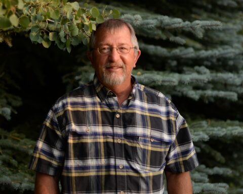
![]()
John Perusek was appointed to the UGRWCD Board of Directors in February 2018 representing Division 8, the City of Gunnison. John currently serves as the Secretary of the Board and serves on the Executive, Finance and Projects board committees. His current term expires in 2022.
As a local boy, John has been engaged in water issues his whole life. John comes from three generations of area ranchers and learned early on the importance of water for irrigation purposes. As a teenager, John started working in the summers at the Mt. Emmons mine near Crested Butte. John said they “liked his skill set” and he was hired on full time in 1984. He continued to work at Mt. Emmons mine in the wastewater treatment plant for 23 years before being transferred to the Climax molybdenum mine near Leadville, where he served as the Maintenance Planner for industrial wastewater treatment for 10 more years. John also earned his earned his Bachelor of Arts degree while working as a contractor at the Mount Emmons prior to being hired full time by the project. He earned his degree in science with a minor in geology from what was then Western State College in Gunnison.
“As a long-term resident of this District, I have seen a gradual shift in our local economy from being agricultural and mining based to more tourism and second-home development based,” said John. “I believe agriculture will always be important for our economy, so I would like for our irrigation systems to be optimized so that those with water rights are able to maximize their beneficial use.”
John credits the District’s grant programming and watershed management planning initiatives in helping optimize irrigation systems and improve water quality for the area. “It takes a lot of planning and engineering to ensure that such projects are going to be successful and benefit the water users and this is where the District can provide funding and expertise,” said John. He encourages individuals and organizations in the District to reach out to the staff and board when considering a water improvement project.
“I think Sonja (Chavez, general manager for the District) is doing an awesome job of partnering with individuals, organizations and other funders to get water optimization projects off the ground,” said John. “The Upper Gunnison River Restoration & Irrigation Infrastructure Improvement Project featured in this edition is a perfect example of this.”
John also says, “We have to take steps to make sure what water we have will last and to ensure that it is of the best quality it can be.”
When not working on water issues, John enjoys golfing and fly fishing and is a big supporter of Western University’s sports program. He particularly likes following the wrestling program and basketball program, as he started wrestling when he was just 8-years-old. John and his wife of 38 years, Colette, are both Western alums so they often enjoy Western sports and activities together. They are also parents to one grown daughter and enjoy spending time with their grandson. John has also been a member of the City of Gunnison’s Planning and Zoning Commission since 2017.
“With his 33 years of experience in water quality management, John brings significant expertise to the Board which is really beneficial,” said UGRWCD General Manager Sonja Chavez. “I really appreciate the knowledge he has of our watershed and the understanding he has of the issues that affect all water users in the District.”
It Takes A Community
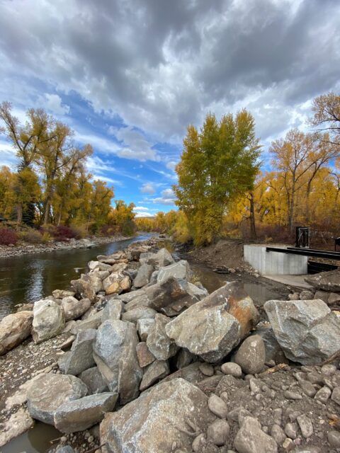
![]()
It started as a grant application to the Upper Gunnison River Water Conservancy District (UGRWCD) from an area agricultural producer who wanted to improve his irrigation headgate. He came to UGRWCD seeking funding assistance to help him offset the costs of his proposed project. Through communication with the downstream irrigation divertor about irrigation water management challenges and interest in shared infrastructure and a chance meeting with the Watershed Management Planning Agricultural Coordinator, thus began the groundwork of the 2021 Upper Gunnison River Restoration & Irrigation Infrastructure Improvement Project.
By taking the approach of combining two parallel and redundant irrigation diversion structures 25 feet apart from each other on the Gunnison River into a single shared point of diversion with modernized irrigation infrastructure, this project resulted in the restoration of a severely impacted segment of the river. For agricultural producers, the project helped protect their water rights and improve irrigation water management, efficiency, and productivity for over 1900 acres of irrigated land in the Gunnison Mainstem and Tomichi Creek sub-basins. For recreational users, the project opened-up the narrowed river channel which was causing erosion and negatively impacted rafting and fishing. Finally, the river improvements benefit the environment by supporting the aquatic community and fishery and bolstering critical wet meadow habitat for the threatened Gunnison Basin Sage Grouse. The project is expected to be completed by November 2021.
In addition to grant funding and in-kind services contributed by the Upper Gunnison District, the project received financial and in-kind support from the John B. Outcalt No. 2 and Gunnison Tomichi Valley Ditch water right holders, Trout Unlimited, Colorado River Water Conservation District Community Funding Program, State of Colorado Stream Management Planning Program, and U.S. Fish & Wildlife Service. ![]()
Easy Money Through Mini-Grants
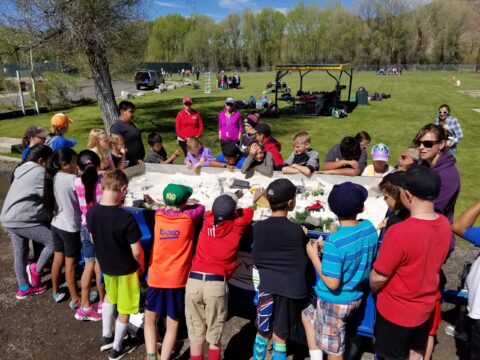
![]()
At the UGRWCD, we believe that most residents of our District understand the importance of responsible water use and water conservation, but sometimes an educational program or creative communication can help remind us all or teach youngsters this important concept. The District can help facilitate such programs and communications through its Mini-Grant Program.
“Perhaps a teacher needs some equipment for a water lab project or an artist needs some supplies for his art class to create artwork on water awareness,” said UGRWCD General Manager Sonja Chavez. “The District is here to help through our simple Mini-Grant Program.”
Chavez noted that these grant funds are available for projects across a wide spectrum of curriculum and can be requested by private citizens, school or university faculty, home schools, preschools, watershed groups, art centers, or other resource organizations that have a message to share about water. RE1J Watershed School District and Western Colorado University students may apply as well. Examples of past projects that were funded include interpretive signs along the Mustang Pond at Gunnison Middle School, U.S. Forest Service request for supplies for the Water Education Trailer owned by the District and shared with partners, and water wader boots for Crested Butte Community School.
The Mini-Grant program can provide up to $300 annually per applicant to support projects designed to expand awareness of water-related issues in the District. Applications can be filled out online and submitted via email or printed off and mailed back to the District. This includes private citizens, school or university faculty, home schools, preschools, watershed groups, art centers, or other resource organizations that have a message to share about the value of water. RE1J Watershed School District and Western Colorado University students may also apply. You can access the application and guidelines directly here: https://ugrwcd.org/mini-grants/.
Upper Basin Drought Response Agreement Releases
The Bureau of Reclamation implemented drought operations under the Upper Basin Drought Response Operations Agreement (DROA) due to declining water levels in Lake Powell. Colorado River Storage Project reservoir releases are as follows: Flaming Gorge Reservoir – 125 kaf; Blue Mesa Reservoir 36 kaf; Navajo Reservoir 20 kaf.
Blue Mesa Reservoir releases scheduled to begin August 2021 as follows: August 14 kaf; September 18 kaf; October 4 kaf; November 0 kaf; December 0 kaf.
Projected end of year (December 31st) content: 234,000 (28%) as of June 9, 2021 Aspinall Operations Report
Taylor Reservoir Releases Set Through September
The Taylor Local User’s Group (TLUG) met on September 2, 2021 and elected to leave the flows as follows: 240 cfs* through September 6, 2021; 135 cfs* September 7 through 30, 2021, then switching to winter flows of 75 cfs* (*subject to change based on current conditions). The TLUG representatives agreed to hold a special meeting (tentatively schedule for September 20, 2021, time TBA) if the mid-month report from the Colorado River Forecast Center varies much from the current forecast. For questions, please contact the District at (970)641-6065.
![]()
UGRWCD Programs and Partnerships
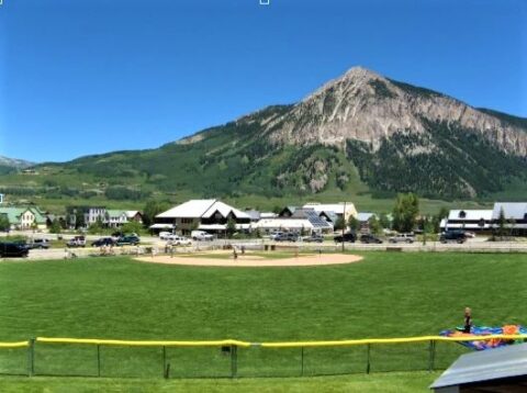
![]()
In the Upper Gunnison River Water Conservancy District’s (UGRWCD) sixty-year history, we have been involved in many programs aimed at benefitting water users in the Upper Gunnison Basin. In more recent years we have expanded our focus into several different areas. We currently have representation on the Taylor Local User Group, Water Quality Monitoring Program, Upper Gunnison Basin Cloudseeding Program, Upper Gunnison Annual Grant Program, and the Upper Gunnison Water Augmentation Programs. We also participate in discussions with the several different entities to address issues facing all water users in the basin in the face of increasing drought conditions and decreasing water availability. Below are descriptions of just some of the programs we work on to benefit water users in the Upper Gunnison River Basin.
Taylor Local Users Group
The UGRWCD is one of four signatories to the Taylor Park Reservoir Operation and Storage Exchange Agreement that was executed in August 1975. The “75 Agreement” forms the basis under which the release patterns from Taylor Park Reservoir are determined each year. The other three parties to the agreement are the U.S. Bureau of Reclamation, the Colorado River Water Conservation District, and the Uncompahgre Valley Water Users Association. This group is referred to as the Four Parties.
Each spring, and as necessary throughout the summer, the UGRWCD seeks input and direction from local users of the Taylor River, Taylor Park Reservoir, and the main stem of the Gunnison River above Blue Mesa as to how the reservoir operations can best be optimized for stream fishery, reservoir fishery, irrigation, and rafting and boating purposes in the upper Gunnison basin. This group is referred to as the Taylor Local Users Group (TLUG).
Each year, the Four Parties review and adopt recommendation from the TLUG at an annual meeting and jointly adopt a plan for reservoir releases for the upcoming year.
Upper Gunnison Basin Water Monitoring Program
The UGRWCD has led the Upper Gunnison Basin Monitoring Program for over twenty years. This program provides an understanding of water quantity and quality conditions, and how natural features and human activities affect these conditions. This program is a cooperative agreement between the District and several other local entities including the U.S. Geological Survey (USGS), Gunnison County, City of Gunnison, Town of Crested Butte, Hinsdale County, Mt. Crested Butte Water and Sanitation District, Skyland Metro District, Crested Butte South Metro District, Colorado River District, U.S. Bureau of Land Management, National Park Service, and the U.S. Bureau of Reclamation.
This cooperative group meets annually to discuss monitoring needs which currently includes real-time streamflow at 11 sites throughout the basin, discrete water quality sampling at those 11 sites, and real-time water quality monitoring at 5 additional sites. Recently, two historic streamflow gages have been reactivated at Texas and Willow Creeks above Taylor Reservoir to aid in annual inflow forecasting.
Finally, UGRWCD is cooperating with the USGS Next Generation Water Observing System (NGWOS). NGWOS is a national program focused on intensive 10 year surface-water and water quality monitoring that is beneficial to improving regional water prediction in snowmelt dominated systems. The 2020 basins of choice are the Upper Colorado River Basin in Colorado and specifically the Upper Gunnison River watershed sub-basin. UGRWCD anticipates that this program will begin in earnest fall of 2021.
Upper Gunnison Basin Cloudseeding Program
The UGRWCD has been part of this cooperative program since the 2004-2005 snow season and took over fiscal responsibility from Gunnison County in 2015. The Cloudseeding Program is carried out through an annual agreement with North American Weather Consultants. Partners in the program include the Colorado Water Conservation Board, Gunnison County, City of Gunnison, Town of Mt. Crested Butte, Vail Resorts, East River Sanitation District, Mt. Crested Butte Water and Sanitation District, Antelope Hills Water, and Dos Rios Water System.
The Cloudseeding Program consists of 14-17 silver iodide generators throughout the basin and one remote generator located at Lake Irwin. The target areas within the basin are those drainages above 9,000 feet that are tributary to the Upper Gunnison River. The average annual generator hours budgeted for this program are 2,500 hours. Actual seeding hours depends upon storm systems moving through the area. In some cases, generation has had to be curtailed due to avalanche danger.
UGRWCD Grant Program
Established by the UGRWCD to protect and conserve the waters within the District in order to accomplish the greatest possible use for irrigation, domestic, municipal, industrial, mining, and all other beneficial purposes. The
mission of the District is to encourage the in-basin beneficial use and maintenance of high quality standards for the water resources of the basin. The District has determined that an appropriate means to effect its purposes and accomplish its mission is to provide financial assistance to persons or entities advancing projects that enhance water supply and stream conditions within the District through a Grant Program.
The first grant awards were made in 2009 when the funding budgeted was $100,000. Since 2009 we have awarded funding to 118 projects for at total of $1.642 million. These projects have ranged in funding amounts from $1,000 to $50,000 and have included projects associated with agricultural, municipal, environmental, and recreational water uses.
Upper Gunnison Augmentation Water Programs
As a result of the over appropriation of water within our basin, the UGRWCD developed plans for water augmentation. The District is currently involved with three separate water augmentation programs. These include the Aspinall Augmentation Plan, the Meridian Lake Reservoir (also known as Long Lake) Augmentation Plan, and the Lake San Cristobal Augmentation Plan. The augmentation plans all provide protection to junior water users from senior water right holders within the boundaries of the individual augmentation plans. These augmentation plans involve individuals purchasing augmentation water which is leasing or buying the right to have water released to protect their uses.
Aspinall augmentation water is water stored and released from Blue Mesa Reservoir. Blue Mesa Reservoir and the water stored there are owned by the US Bureau of Reclamation. Water purchased under this plan protects junior water users from senior water rights holders below Blue Mesa Reservoir. Meridian Lake Reservoir protects against senior water rights holders below that reservoir, and Lake San Cristobal protects against senior water rights holders below Lake San Cristobal to Blue Mesa Reservoir.
Bill Nesbitt UGRWCD Board Member Profile
![]()
Bill Nesbitt was appointed to the UGRWCD Board of Directors in June 2008 representing Division 8, the City of Gunnison. Bill currently serves as the Treasurer of the Board, a position he has held since 2014. His current term expires in 2024.
“Serving on the UGRWCD board for the past 13 years has been a challenging and rewarding effort. The board meetings have never been boring because of the myriad of interests dealing with water quality/quantity issues and the diverse make-up of the board members” said Director Bill Nesbitt.
During his tenure, he has seen the board change from managing irrigation water needs to leadership in the development of programs which benefit the community and the basin as a whole and becoming a multi-jurisdictional force on state-wide water issues. Through board members’ and staff’ involvement in Colorado Water Congress, Gunnison Basin Roundtable, and the Colorado River District, the words “transmountain diversion”, although still talked about, do not create heated discussions as once was the case. “It has been fulfilling to see the Board’s continued interest in community education and outreach. One of the great programs is the annual Grant Program. In 2009, we funded two projects in the District totaling $45,000. At the conclusion of the 2021 grant cycle, the board has now funded 118 projects in the basin to the tune of just over $1.64 million. That is taxpayer money being returned to the taxpayers.”
“I am really gratified to have been active in the growth of our financial position at the District,” said Nesbitt. “I take the Board’s fiscal responsibility very seriously and am proud to note that while we have been able to successfully grow our reserves, the District has also increased its support of programming that has enhanced our water supply, improved our water quality or protected our water resources.”
“In addition to the Grant Program, the District is also providing matching funds and other resources for other private and public entities in our District who are collaborating with us on assessments, engineering and water projects that will help us meet our mission,” said Bill.
“The District Board deals with such a wide variety of subject matter that affects our leadership and decisions,” said Bill, “including everything from water rights to scientific research and data about our watershed, to climate change, to agricultural needs, to land development, to legislation, to mill levies, all of which we must do our best to understand in order to make the best decisions for the District.”
As Chair of the Outreach/Education and Finance Committees, Bill has been active in promoting the District’s mission in the community through the many other civic and governmental organizations he is involved in, as well as to school children in the valley.
“For many years now, I have enjoyed delivering copies of the book called Water, by Frank Asch to help educate the first graders in the Gunnison Watershed School District about the water cycle and the importance of conservation,” said Bill.
After graduating from Western State College (now Western Colorado University) in 1974, Bill started a construction and remodeling business with partner Bill Yanaki and in 1985 became a real estate broker. During his many years in Gunnison, Bill has been active in numerous city, county and state organizations. He served the City of Gunnison for 21 years on the City Council, Planning and Zoning Commission and was Gunnison’s Mayor from 1989 to 1991. He has also been active in Region 10 serving as its Chairman in 1989 and spending nearly 20 years as a member of its Revolving Loan Fund. Bill has also served on the Gunnison Valley’s Tourism Association and the Gunnison Area Chamber of Commerce. From 1990 to 2000, he was appointed by Governor Romer to the Small Business Council, one of 23 members statewide, lobbying and working with legislators to create legislation to assist small business in Colorado. He presently serves as a Governor appointee to the Gunnison Basin Roundtable. Bill is owner of Nesbitt & Company LLC, a property management and real estate brokerage firm serving the Gunnison Valley.
In his rare spare time, Bill enjoys hunting, fishing and gardening and spending time with his family, including his wife, Betsy and his grown children, Billy, Matt and Catherine.
“I think that my 50+ year involvement in the valley as a business owner, parent, and elected and appointed official has been helpful tothe UGRWCD. The board make-up has lots of diversity, and depth. The Board as a whole has a continuing commitment to the legacy of ranching and management of the most precious resource in the basin, in my opinion, — WATER!” said Bill.
UG Basin Meadow and Riparian Restoration Project (Wet Meadows)
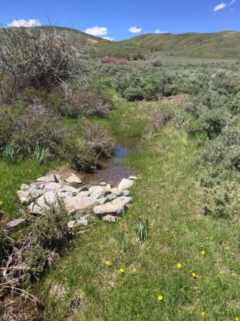
![]() It begins with a faint sound, a chuckling burble, like a mountain stream running under a foot of new snow. Except there is no snow or stream in this wide grassy space surrounded by sagebrush. As the predawn light begins to climb in the eastern sky, an occasional flash of white blinks thorough the darkness. The sound spreads, and as the light comes up, the display of the male Gunnison sage-grouse becomes visible. A dozen dark chicken sized birds inflate and deflate air sacks in their chests, faster than the eye can see, while stroking the stiff white breast feathers covering their chests with their wing tips. At the same time, they weave, bob, and duck their heads, flipping their filoplumes, a hipster like ponytail over their heads. More mature birds, chase their younger rivals off of the dancing ground or lek, while the smaller more cryptically colored females move surreptitiously through the gyrating males, in one of the most highly selective breeding cycles in North America, where 10 percent of the males do 90 percent of the breeding. After breeding on the same leks their mothers did, the females return to the deep sage, often within yards of the area where they were hatched to lay their eggs. Laying up to a dozen eggs, the chicks hatch simultaneously, emerging from the egg with yolk reserve to survive for 18 hours, the hen must move the chicks from the dense sagebrush she nested in to a moist area, with abundant insect life. For the first 21 days of their lives, Gunnison sage-grouse chicks rely on insects for their food, and after three weeks begin to forage on a mixed diet of insects and flowering plants. These mesic sites are rare in the arid sagebrush system, comprising less than 1% of the landscape, and many have been impacted by roads and other man-made impacts.
It begins with a faint sound, a chuckling burble, like a mountain stream running under a foot of new snow. Except there is no snow or stream in this wide grassy space surrounded by sagebrush. As the predawn light begins to climb in the eastern sky, an occasional flash of white blinks thorough the darkness. The sound spreads, and as the light comes up, the display of the male Gunnison sage-grouse becomes visible. A dozen dark chicken sized birds inflate and deflate air sacks in their chests, faster than the eye can see, while stroking the stiff white breast feathers covering their chests with their wing tips. At the same time, they weave, bob, and duck their heads, flipping their filoplumes, a hipster like ponytail over their heads. More mature birds, chase their younger rivals off of the dancing ground or lek, while the smaller more cryptically colored females move surreptitiously through the gyrating males, in one of the most highly selective breeding cycles in North America, where 10 percent of the males do 90 percent of the breeding. After breeding on the same leks their mothers did, the females return to the deep sage, often within yards of the area where they were hatched to lay their eggs. Laying up to a dozen eggs, the chicks hatch simultaneously, emerging from the egg with yolk reserve to survive for 18 hours, the hen must move the chicks from the dense sagebrush she nested in to a moist area, with abundant insect life. For the first 21 days of their lives, Gunnison sage-grouse chicks rely on insects for their food, and after three weeks begin to forage on a mixed diet of insects and flowering plants. These mesic sites are rare in the arid sagebrush system, comprising less than 1% of the landscape, and many have been impacted by roads and other man-made impacts.
Since the early 1900’s, the available habitat for the Gunnison sage-grouse has shrunk by an estimated 90 percent. In 2014, the bird was listed as Threatened under the Endangered Species Act by the US Fish and Wildlife Service. Currently, 85 percent of breeding of the entire Gunnison sage-grouse population takes place in the Gunnison River Basin. In 2009, the Nature Conservancy convened a group of representatives from public and private organizations to form the Gunnison Climate Working Group with the goal of “working to build the resilience of species and ecosystems so that they continue to provide benefits to the people of the Gunnison Basin.” More specifically, the group collaborated to gain understanding of the potential threats posed by climate change to the Gunnison sage grouse and other species; identify strategies to reduce adverse impacts from climate change and other threats; and, to promote coordinated implementation of these strategies. Initially, the Working Group included representatives from: Bureau of Land Management, Colorado Natural Heritage Program, Colorado Parks and Wildlife, Gunnison County, Gunnison County Stockgrowers Association, National Park Service, National Center for Atmospheric Research, Natural Resources Conservation Service, Rocky Mountain Biological Laboratory, US Fish and Wildlife Service, US Forest Service, Upper Gunnison River Water Conservancy District, Western State College and Western Water Assessment, University of Colorado, Boulder. Oversight and leadership were provided by The Nature Conservancy. In December 2011, the Gunnison Basin Climate Change Vulnerability Assessment was published, which led to further development of specific rehabilitation and riparian projects to address declining habitat.
Since 2012, the group evolved and now includes more than 35 organizations and private landowners. In 2017, the Upper Gunnison River Water Conservancy District (UGRWCD) took over the leadership and oversight of the private/public working group. Tom Grant was hired in 2017 as the “Project Coordinator.” Paul Jones succeeded Tom in this role in 2019.
Since 2012, 1,946 structures have been built under the project, restoring 180 acres of riparian wetland habitat and 1,260 acres of grouse habitat along almost 27 stream miles in the Gunnison Basin and satellite populations (San Miguel Basin, Pinon Mesa and Crawford).
Project Coordinator Paul Jones notes that these “structures” are mostly hand built using stones, earth and other vegetation. Some structures are also built with heavy equipment. The structures are not designed to “store” water, but to slow it down, spread it out and rewet the “sponge” of which wetlands are comprised.
Paul points out that these structures are beneficial in multiple ways. “Not only have these hand-built structures allowed us to restore over 1200 acres of sage grouse habitat, but they have also improved forage availability on both public and private land for stock growers,” said Paul.
Paul notes that the success of the project has been very rewarding as he has witnessed a 200 percent increase in wetland vegetation in the project areas the partnership has worked in. “The project has been successful in securing well over $1 million in grants, which is critical for funding the project, yet also results in a significant amount of administrative time and expense to meet all of the grant requirements,” Paul said. “In addition with population growth and continuing climate decline, it is a race against time to protect and repair as many acres of the wetland as quickly as we can.”
“We would love to see more private landowners getting involved in the project and find more local champions to promote our goals,” said Paul. “The proactive conservation measures undertaken by this group and many local volunteers have already benefited the Gunnison sage-grouse. Our goal is to recover wetlands to the point that this amazing species no longer needs federal protection.”
The UGRWCD believes it is this type of collaborative project that can effectively prepare nature and people for an uncertain future and this is why it supports the “Wet Meadows Project.” If you would like to become more involved or want more information about the project, please visit the wet meadow restoration website at www.UGmeadowrestoration.com or contact the District at (970)641-6065.
Gunnison River Festival 2021
The 18th Annual Gunnison River Festival was held June 11-13, 2021 with three great days of “Celebrating the Rivers” of the Upper Gunnison Basin, including the favorite Taylor Downriver raft and kayak races, and new this year – educational seminars, dry land and in-flow clinics, virtual races and the inaugural “Run the Gunnison 5K” footrace at VanTuyl Trail.
“After a year off due to the pandemic, it was so great to get to celebrate again in person and take advantage of the great weather and good stream flow,” said Joellen Fonken, director of the Gunnison River Festival, a nonprofit organization who’s title sponsor is the Upper Gunnison River Water Conservancy District.
Joellen noted that the festival would not be possible without funding assistance from these sponsors: Merrick & Company, Tava Real Estate, High Country Conservation Advocates, Lake Fork Valley Conservancy, High Mountain Liquors, Gunnison County, City of Gunnison, Gunnison BLM and American Whitewater.
![]()
The women prepare to dig in for the Women’s Division of the American Whitewater Taylor River Raft and Kayak Races. The women’s division was won by Kestrel Kunz.
![]()
Even a dog got in on the rafting! The overall winner of the American Whitewater Taylor River Raft Race was Jennifer Hodgkiss and team.
![]()
The competition in the Men’s Division of the American Whitewater Taylor Kayak Races was tight with Daniel Kreykes crowned the overall winner.
Stage 1 Fire Restrictions Enacted
![]()
Stage 1 Fire Restrictions have been enacted for most of the Upper Gunnison River Basin. It’s very dry out there, so please be extra careful. Read more here: https://ugrwcd.org/wp-content/uploads/2021/06/GFO-Fire-Prevention-Order-Stage-1-6.24.21-Signed.pdf![]()
TLUG Monthly Meeting Notice
The Taylor Local Users Group will meet on Friday, August 6, 2021 at 9 a.m. This will be an in-person meeting at the Upper Gunnison River Water Conservancy District offices, 210 W. Spencer Ave., Suite B in Gunnison. It will also be offered via Zoom video/teleconferencing for those unable to attend in person. Please pre-register if you plan to attend by Zoom using the following link. If you have any questions, please contact the District at 970-641-6065 or sue@ugrwcd.org
CWCB Demand Management Statement
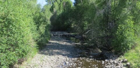
![]()
Following nearly two years of stakeholder discussions and input from Coloradans across the state and from various sectors, the Colorado Water Conservation Board (CWCB) released a draft Demand Management Framework. The Framework captures threshold issues; implementation options; and proportionality, fairness, and equity considerations.
Demand Management is the concept of temporary, voluntary, and compensated reductions in the consumptive use of water in the Colorado River Basin in order to ensure ongoing Colorado River Compact compliance and avoid involuntary curtailment of Colorado water uses.
Notes to consider while viewing the Framework include: Demand Management is not a foregone conclusion; The framework is not a program, but a point for discussion; Issues will continue to be explored in an open and collaborative manner; and a program would be run by the state for the benefit of the whole state and its water users.
The CWCB is currently scheduling several virtual events to ask questions and provide input on the Framework from April through June 2021. Details will be published on the Demand Management Upcoming Events chart online.
Following these initial workshops and meetings, CWCB staff will host a Demand Management Public Listening Session on June 29. CWCB staff will track the input received and then present findings to the Board in July 2021.
In addition to attending a workshop or listening session, interested parties and individuals are encouraged to complete the public survey on engagecwcb.org or submit a question or comment to demandmanagement@state.co.us.
“We look forward to continuing this open and collaborative feasibility investigation, now focusing on various implementation options for a potential Demand Management program,” said CWCB Director Rebecca Mitchell. “We encourage all Coloradans to help inform the investigation by reviewing the Framework, attending a workshop, and filling out our online survey.”
Demand Management Engagement Process
![]()
UGRWCD Announces 2021 Grant Awards
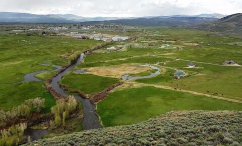
![]() Photo of Tomichi Creek Wetlands Preserve
Photo of Tomichi Creek Wetlands Preserve
The Upper Gunnison River Water Conservancy District (UGRWCD) recently awarded over $191,000 to organizations and individuals in the Upper Gunnison Basin for projects that will enhance water supply or improve stream conditions. Some of the projects awarded include efforts to improve water system supply and efficiency, delivery structure or system improvements, restoring or enhancing riparian habitat, and addressing water quality. All recipients of the grant funding assistance awards were required to show a 50 percent match of funds requested and their projects had to be consistent with the District’s purpose, mission, and objectives.
This year’s funding allocation is one the largest amounts the UGRWCD has awarded through the funding assistance program, which originated in 2009, second only to 2020 when $200,000 was awarded.
“We were delighted with the number and quality of the grant applications that we received this year,” said Sonja Chavez, general manager of the UGRWCD. “These funds will go to support projects that help us achieve our mission to be an active leader in all issues affecting water resources in our basin. Many water users in our District will directly benefit from these projects when completed, so we are honored to be able to help with their funding.”
The UGRWCD Funding Assistance Program follows an annual cycle with applications due in February each year. If you have a water project in mind that might qualify for grant funding through the UGRWCD, please call the District at (970)641-6065 for assistance and information.
2021 UGRWCD Funding Assistance Grant Program
The Upper Gunnison River Water Conservancy District Board of Directors announces the availability of $200,000 in Upper Gunnison Grant Funding for projects within the District that would enhance water supply or improve stream conditions. Projects may include but are not limited to water system efficiency, delivery structure or system improvements, construction of new storage impoundments, enlargement or rehabilitation of existing impoundments, and restoring or enhancing riparian habitat. Requests for financial assistance will be considered only for projects that are consistent with the District’s purpose, mission, and objectives, and that have a 50 percent match. Water supply projects that provide benefits for agricultural, municipal, domestic, environmental or recreational uses are considered eligible.
A virtual grant program informational meeting will be offered for interested applicants on Friday, February 5, 2021 at 1PM (contact the District for information).
Project applicants must submit an application to the District by close of business, February 26, 2021. Application materials can be obtained via the District website, www.ugrwcd.org, or by contacting the District office at 210 W. Spencer Avenue, Suite B, Gunnison, CO, 81230, 970-641-6065, beverly@ugrwcd.org. For complete details, including the application, please read more HERE
Gunnison High Students Present at the Healthy Rivers Youth Water Summit
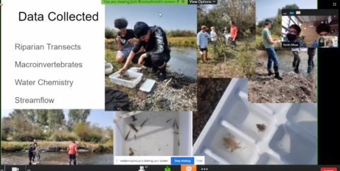
Congrats to Gunnison High School students Kevin Meza and Josh Brockschmidt on a GREAT Colorado RiverSCAPE presentation about Tomichi Creek for the Healthy Rivers Youth Water Summit! It was an informative, thought provoking address about our watershed. These young men clearly demonstrated their understanding of the science behind their subject and how to conduct a research project. Kudos, too, to their teacher, Krystal Brown, for educating our future leaders about these important water issues and conservation. Our future looks bright!
THANK YOU WESTERN VOLUNTEERS!
Hands on in Tomichi Creek
By: Taylor Paulson, Intern
The best way to really understand a river is to wade right in. It can be very calming to get away from the busy main streets of town and wander through the tall grass and growing aspen trees to Tomichi Creek. Tomichi Creek is a tributary to the Gunnison River that flows by the town of Gunnison, Colorado, from the Continental Divide and Monarch Pass Area.
Jesse Kruthaupt with Trout Unlimited leads the way to Tomichi Creek. We are conducting a river cross section with a staff gauge in order to begin the flow measurements. We are going to be taking a cross section in order to measure the flow of the creek. Jesse reads the staff gauge to get the reference point for the flow readings and sets up the tagline (a measuring tape that crosses the river to measure the river’s width) perpendicular to the river for an accurate cross section. Once the flow meter is set up to the handheld computing device, each water column can be measured for an average flow which is measured in cubic feet per second. Jesse assesses the cross section of river and determines that average flow measurements will be taken at two feet intervals. This means that each water column is two feet wide and the depth is taken concurrently with the average flow for that given two feet wide section or water column of the creek.
As I assist Jesse with the flow meter, we notice the trout in Tomichi Creek rising to feed on the flies buzzing along the surface. It’s a cooler morning in June but the creek is still low for this early in the year. I can’t help but think of the consequences the valley will face in this low water year. The fish are particularly sensitive to rising temperatures. High flows are great for the trout because the water stays colder and there is more area in the river for the fish to hole-up. In lower flows the temperature fluctuates more easily and forces the fish to drop into the deepest part of the river. This results in more fish in each hole fighting for food sources in a smaller area.
This year I choose to be optimistic and hold out hope that monsoon season treats the Gunnison Valley well while protecting the fish and well as the people living here.
Water in the West: Meridian Lake
By: Marissa Markus
Also on May 11th, Frank and I visit Meridian Lake Reservoir near Mount Crested Butte. Frank visits Meridian Lake Reservoir every month to inspect and report the storage amount, percent capacity, seepage, and any net changes in storage. He shares his most recent report from late March when he visited the lake with Water Commissioner, Tom Rozman, so that I have a sense of what I am getting myself into. As an intern, I had no choice but to roll up my pantlegs and cross the icy waters of Washington Gulch to access Meridian Lake Reservoir. Thankfully, Frank crosses first, and he throws me a life line by tossing his trekking poles back for me to use. As you can see in the picture, after we wa de the creek, there is still a little snow that we push through to conduct this month’s inspection. Making my way through the creek and snow, up a steep hill and to the water’s edge, I think back to my last visit to Meridian Lake Reservoir in the summer of 2008. At the time, I had had no idea that I was swimming in a dammed lake. Well, I’ll be damned if such a small structure is considered a dam! And although I enjoyed my first swim in the lake back in 2008, I am not eager to take a dip this trip. . . I am there to observe and learn.
Frank informs me that Meridian Lake Reservoir was formed naturally by beaver damming, and then some time in the 1950’s, the Rozman family constructed a little dam to maintain water storage. The lake became a focus for the Upper Gunnison River Water Conservancy District in 1998 because of nearby development and augmentation. Then the 2002/2003 drought exposed the vulnerability of basin water users to senior downstream water rights, and it was time to take action. In 2005, the Upper Gunnison River Water Conservancy District purchased the water rights from the Rozman family in response to the need for an augmentation plan. They rebuilt the dam to current standards, and Meridian Lake Reservoir now serves augmentation needs for junior uses on Washington Gulch, Slate River, and the Upper East River. It was purchased for $750,000, and after 12 years, UGRWCD just achieved cost neutrality. We are very fortunate that the UGRWCD voluntarily took this responsibility upon themselves. A lack of planning by public officials and developers could have left homeowners up a creek without a paddle…. While it continues to serve constituents with affordable water replacement for depletions, it also serves as a popular destination for the recreation and fishing communities. That’s why you’ll find me wading the stream crossing once again this summer.
Water in the West: 4th Grade Water Festival
By: Marissa Markus
On May 26, 2017, I attended the 4th Grade Water Festival. The water festival is an annual event that has been occurring in Gunnison for over ten years. Throughout the course of the day, students participate in eight workshop stations. They eagerly learn and share their existing knowledge about water in the Gunnison watershed. I am surprised by students’ existing knowledge and their willingness to engage in conversation with station educators. The entire festival was a rewarding experience for students, educators, and observers. I am thankful for all the hard work that goes into organizing such an event and for the role the Upper Gunnison River Water Conservancy District plays in the event.
The Upper Gunnison River Water Conservancy District supplies a hands-on educational stream trailer for their station. Liz With and interns take turns leading the stream t railer curriculum. Liz asks Ashley Cook’s 4th Grade class to share what they know about sediment, erosion, aquifers, ground and surface water, watersheds, riparian areas, run-off, permeability, channelization, and meandering streams. After some discussion, it’s time for students to get their hands dirty and participate in a couple experiments. First, Liz turns the water on to show the differences between channelized and meandering stream systems. Students are entertained as cows, fences, structures, and sediments are pulled into the flow of the channelized system. Students also point out that the water moves more slowly through the meandering system. Then, students separate into groups and are challenged to restore the channelized system and to properly divert water to irrigate an alfalfa field without jeopardizing the meandering stream. Within a short time, the groups work together to create a plan and use the materials provided to achieve their tasks. A student, Maggie, explains how they add vegetation and rocks to help restore the channelized system. Another student explains the irrigation structure they built. While there are some successes and some mistakes, students leave the station with lessons learned and a smile.
Students attend a presentation on agricultural water use and plant dynamics by Eric McPhail with the CSU extension. Eric, with obvious artistic ability, draws the roots, root hairs, trunk, branches, and leaves of a tree. He explains the process of transpiration and uses a plastic straw to help students understand the role of xylem in water transportation. Following a short but informative presentation, it is time for fun. Students split into groups of boys versus girls. Their objective is to mimic water transportation, to move water up through a straw without sucking or blowing directly in the straw. Students take a second straw and blow across the top of the straw placed in the colored water. This creates a difference in pressure that pulls the water up the straw. Then, one student climbs to the top of a ladder and pretends to be a tree. He is a couple feet above a cup of water. He sucks through an elongated straw in order to pull the water all the way up to his leaves. He raises his arms as he successfully takes a sip! A greater appreciation for the hard work of plants and plant systems is developed.
There is also a presentation on fisheries ecosystems by Dan Brauch with Colorado Parks and Wildlife. The students act out the life cycle of a kokanee salmon (Oncorhynchus nerka). Students are selected to either act out the role of a kokanee salmon or the role of a limiting factor. The salmon (students with the assigned role) are released from the hatchery, where they have to travel to Blue Mesa Reservoir, survive for 2-5 years, and then travel upstream to spawn. With limiting factors restricting the number of kokanee salmon that make it back upstream, not many students make it to the end of the course. They frantically run around and most of them have been snatched up by lake trout, which grow to be just about the same size as a 4th grade student. Maybe a little exaggeration there, but it got the point across to the students. Then the number of kokanee salmon is increased, the number of limiting factors like lake trout are reduced, and the life cycle is reenacted. Students more successfully run through the course of the kokanee life cycle. Dan asks students to explain the limiting factors and students provide answers like predation, dams, and anglers. Students then expand on ways to address or manage for the limiting factors of kokanee salmon in our own Blue Mesa Reservoir.
Laura Tomcek with the National Park Service discusses the importance of water conservation at her station. First, she uses a gallon of water to represent all of the water on Earth. She uses a quarter cup to represent the fresh water. Two tablespoons make up the liquid freshwater, and eight drops from a dropper make up all of our rivers and lakes. Then students discuss ways humans use this limited resource. Our three biggest uses of water are leaky faucets, washing machines, and showers. Well informed, they are ready to run through a relay race. They split evenly into teams to race each other. Rolling dice at the leaky faucet station, each student hops on one foot the number they rolled with a full glass of water. They move to the washing machine station where they spin a number of times, and then they pour the water back and forth between two cups at the shower station. They race to the end, empty the remaining water into a bin, and race to hand off the cup to the next student. The group that conserves the most water joyously wins the race.
Dan Zadra and Brandon Diamond with Colorado Parks and Wildlife lead discussions about wildlife that utilize riparian habitat. Skulls and pelts line a log by the Gunnison River. This includes species like moose, badgers, coyotes, and prairie dogs. Dan uses the teeth, eye location, and nasal cavity of each skull to help identify 1) species 2) their food source and 3) how they depend on riparian habitat. He fills the presentation with helpful sayings like, “eyes on the side, born to hide, and eyes in the front, born to hunt.” A moose has teeth for grinding vegetation so they are herbivorous. They are heavily dependent on the vegetation that grows within a riparian area. Also, having eyes on the side, students know that they are prey, vulnerable to predators, and can benefit from having a greater range of vision while their head is lowered for grazing.
Jim Lovelace with the Bureau of Land Management demonstrates the significance of ethical camping. He informs students about where to camp, where to go to the bathroom, and where to dispose of waste in riparian areas. Students put a flag where they think they should go to the bathroom, and at the end of four presentations, students observe the sheer number of flags waving in the wind. Students also learn about the problems associated with camp fires. Fires sterilize soil and the number of fire rings can drastically increase like the number of pin flags used to show bathroom spots. Jim demonstrates solutions to reduce fire rings and shows students the appropriate size wood to burn.
Nicole Gibney with the National Park Service introduces students to macro-invertebrates. First, students break down the meaning of aquatic macroinvertebrates. They learn about life cycles and metamorphosis. Macroinvertebrates are in their juvenile state in the water, and this is when it is the most fun for students to catch and try their hand at identifying the aquatic critters. The water is flowing pretty quickly through the Gunnison River, so Nicole took the pleasure of collecting samples ahead of time and placing them in tubs with helpful identification keys. Students huddle around the tubs and spend a little time looking at different macroinvertebrates.
Last, but certainly not least, Ashley Hom with the US Forest Service guides students through the process of calculating stream flows and the significance of understanding stream hydrology. She even helps me to better visualize and guess the quantity of water flowing through the Gunnison River. Ashley starts out by introducing students to United States Forest Service and their role in our public lands. She informs students about good stewardship practices by inserting fun sayings like, “don’t leave your TP from your pee-pee.” She then brings some real science into the mix, and students measure how quickly a stick floats 100 feet in 10 seconds. Students compare their estimated flow rate of cubic feet per second (cfs) against their calculated cfs flow rate.
At the end of the day, everyone has learned a lot, including myself. This is a fantastic event, and I am grateful for having attended and even participated. I would personally like to thank the presenters who took the time to plan and organize such fun and educational stations. The community benefits significantly from a deep understanding of our watershed. They also walked away with the tools they need to be environmental stewards and best practices for water resources.
Water in the West: Lake San Cristabol
By: Marissa Markus
On May 11th, Frank and I made the scenic road trip from Gunnison to Lake City to tour the natural and picturesque Lake San Cristobal. We looked for the Slumgullion slide that formed Lake San Cristobal about a thousand years ago after the slide blocked off the Lake Fork of the Gunnison River. We drove partially up Slumgullion Pass and stopped at an overlook still splotched with snow. Below us was a breathtaking view of Lake San Cristobal. It seemed peaceful and quiet compared to the hustle and bustle of the summer season. Right now, the reservoir fills from spring runoff. This is crucial to fulfill Lake City’s plan for augmentation.
Lake City has 1999 junio r water rights for two municipal wells, but the 2002 drought brought to light the realistic threats a changing climate has on accessing water. The Upper Gunnison River Water Conservancy District participated in a partnership to install a spillway gate at the historic outlet of the lake. This project was a partnership with Hinsdale County and the town of Lake City. The purpose of the spillway is to control the top three feet of lake storage that can then be used to help augment existing and future wells in Lake Fork Basin. This helps protect users against downstream calls. In addition, it maintains lake levels for uses like recreation and fishing.
Frank and I drove down the pass to take a closer look at the Obermeyer spillway gate. The gate was installed in 2012 and uses an air-filled bladder to raise, lower, and reposition the gate. The appealing thing about this gate is that it doesn’t take away from the aesthetic beauty of the natural lake, which brings recreational tourists and locals alike to explore the lake’s potential. Monte Hanna, with Hinsdale County Road and Bridge Department, helps as we measure the lake height on the staff gage and make minor adjustments to the Obermeyer controls. Frank literally lays on his stomach across a boulder below the spillway gate to get an accurate read on the gage. He’s dedicated. Fortunately, with such dedicative efforts from UGRWCD, Hinsdale County, and the Town of Lake City, this project successfully protects instream flow and minimum lake levels determined by the Colorado Water Conservation Board and augments water for the city, all while maintaining the aesthetic beauty of the lake.
Water in the West: Balancing Water Users’ Needs
By: Marissa Markus
On May 10, 2017, I attended the Taylor Local User Group (TLUG) meeting as a guest. TLUG meetings are held at the Upper Gunnison River Water Conservancy District (UGRWCD) office for users of Taylor Park Reservoir and Taylor River. UGRWCD hosts a diversity of meetings pertaining to constituents and their water management needs, but the purpose of this meeting was to incorporate users’ flow requests into the Taylor Park Reservoir operations plan proposal. Earlier this year, the group met and discussed how much water they wanted and when. In general, the plan incorporates hydrologic conditions, ramping rate stipulations, peak flow targets, end of year flow and storage targets, and release requests by users and requests discussed at the Four Parties meeting. The plan utilized the May 15 forecast data of 107,000 acre feet (AF) of April-July runoff into Taylor Park Reservoir. The plan was then updated and included actual data through May 18th. Even since then, Frank Kugel, the General Manager at UGRWCD suggests that since inflows to the reservoir have been higher than previous projections, there may be a need to increase releases beyond what is presented in the current plan. Adjustments could be made to prevent Taylor Park Reservoir from spilling. This means that Frank will have to continue to make changes to his fun and fancy excel spreadsheets that compiles data and helps forecast flows.
As you may have noticed, predicting and managing flows for a diversity of stakeholders can be complicated and requires frequent adjustments. As Frank likes to say, “If everyone leaves equally mad, then I have done my job.” I didn’t find that to be the case, though. Remembering that this year is forecasted to operate as a wet year, I felt a good sense of community at the meeting. Frank successfully coordinated with Bureau of Reclamation, the angler representative, the agriculture representative, the private land representative, the Uncompahgre user representative, the marina representative, and the fisheries representative to adopt an operating plan for Taylor Park Reservoir. Managing flow releases from the reservoir is no easy task, but I would like believe that if there is a water challenge, UGRWCD likes to take a stab at a solution. Better yet, in this case, they created a useable solution and reasonable plan.

Water in the West: Intern Introduction
By: Marissa Markus
I would like to introduce myself so that I may explain how I became so interested in watershed management. I moved to Gunnison, Colorado in August of 2008 from Kingwood, New Jersey. Gunnison appealed to me for several reasons, one being that it was so similar and yet so different from where I had grown up. Gunnison and Kingwood are both small, rural towns filled with charismatic and hardworking individuals, making Gunnison instantly feel like home. I’ll admit it though, it did take me a while to not miss the thick, green forests of Kingwood a nd appreciate the dry, patchy sage-steppe of Gunnison. A while being about two years. I vividly remember the moment I did start to appreciate it. I had just spent a little time traveling, and I was driving home (to Gunnison) from Denver. Afternoon storms had just finished blowing over and everything was happily wet. I rolled down my window and was surprised by the prominent smell of sagebrush. I used to like the way the rain smelled in New Jersey too, but this time I had missed the smell of sage. That was when I realized that every place, every habitat had something unique and wonderful at least hidden within. I would spend the following seven years developing an intimate relationship with this place, my home, and our community of Gunnison, Colorado.
I graduated from Western State Colorado University (WSCU) in 2012 with a double major in Environmental Studies and Ecology. Upon graduating, I began digging my roots deep in the ground because, well, that’s where the water is. I became a wildlife research technician, and I worked with the Uncompahgre fritillary butterfly and white-tailed ptarmigan in the alpine, Gunnison sage-grouse and Gunnison prairie dogs in the sage-steppe, and burrowing owls and black-footed ferrets in the grasslands. You name the species, I probably lovingly harassed it. Having said that, the summer of 2013 was the most time I had ever spent wandering around the sagebrush. Simply put, it was humbling, and I was honored to do the work I was doing. Being in love with this place, I could not help but begin to question whether my work was a reasonable contribution to the land and its constituents.
I was always drawn to the water. The wetlands were literally in my backyard in New Jersey and the Gunnison River has been out my front door here. It is beautiful, powerful, ebbing and flowing, stubborn yet flexible, hot or cold with little in-between, a trickle or a rush, and a life breathing force. I could go on … but basically I can relate because it’s a lot like me. Or one could at least dream big, right? On a serious note, it is a great and powerful resource that needs to be delicately balanced or life cannot sustain. If we do not use it wisely at the headwaters, then the consequences are ten-fold. Drawing from this passion for water that has always been deep inside me and with this yearning to make a positive influence in our community, I enrolled in the Master’s in Environmental Land Management Program (MEM) at WSCU.
With my history o f wildlife research and writing dry, scientific papers, I hoped to easily transition from biology to hydrology. I figured I could at-least get my feet wet, so to speak, and start to network within the water community. I recently accepted an internship position with UGRWCD as an opportunity to learn 1) how water is managed in the Gunnison River Basin and 2) what the UGRWCD’s role is in that management. I never thought that I would find myself here, blogging for UGRWCD, because I love how reclusive wildlife research can be and how impersonal scientific literature is. I quickly surrendered to the fact that water is a social issue, and I’ll have to be both personable and passionate to address the issues surrounding water. It is an issue that directly influences my home and my community. Thus, I started volunteering on the Wet Meadows Project which works to restore critical riparian habitat, I attended water conferences, and I started attending UGRWCD board meetings. At this point, I am still enthralled with this organization, and I am thrilled to tour water projects in the basin and attend meetings and workshops.
Cottonwood Seeds
Good ideas are like cottonwood seeds .
Floating by gently in the breeze,
Swirling in the air currents with ease.
![]()
Dearly beloved trees,
Why do you choose to hold on to your leaves?
And why do you choose to let go of your seeds?
Maybe it is so they take root.
Like an idea in our minds,
That grows with passing time.
Sometimes
It takes work to nurture these things
Dearly beloved mind,
Please let now be the time.
Let these ideas take root!
And from that my roots shoot!
If this idea can’t
Tomorrow is another chance
To watch the cottonwood seeds dance
By: Carlo Demma
UGRWCD Mini-Grant Program
The Upper Gunnison River Water Conservancy District (District) has established a mini-grant program to support educational projects designed to expand awareness of water-related issues in the Upper Gunnison Valley. Grant requests may be up to $300.
Anyone currently engaged in education activities within the Upper Gunnison River watershed (upstream of Blue Mesa Dam) is eligible to apply for a mini-grant. This includes school or university faculty, watershed groups, or other resource organizations with a strong water connection. Western State Colorado University students developing and teaching water curriculum as part of a class may also apply.
For more information, please see the guidelines, or contact the District at beverly@ugrwcd.org or 970-641-6065.
Continue reading